Showing posts with label 1st Avenue. Show all posts

Thursday, February 12, 2026

First Avenue Corridor Redevelopment Plan

Map of area under discussion
Micro-area map

(2/12/2026) Can a historic neighborhood business district near downtown be reincarnated in the 21st century?

The City of Cedar Rapids is preparing a Corridor Redevelopment Plan for First Avenue East between 12th and 16th Streets, roughly the same area as covered in the First Avenue East Micro-Area Action Plan adopted in 2025 (Nieland 2025). That plan, while not bold, took notice of the problems that have accumulated over the years in this area:

  • It is historically a neighborhood business district in an area where housing stock and population have been declining for decades
  • So, businesses have neither the surrounding population to support a neighborhood business nor parking capacity for chain retail
  • It is the main commercial street for the Mound View and Wellington Heights neighborhoods, but with 20,000 cars a day along five lanes it mainly serves as a highway between Interstate 380 and points farther out
  • So, walking across or along 1st Avenue is highly unpleasant and dangerous
row of small, older buildings along 1st Avenue
Modest development across 1st Avenue from Coe College

Ideas to mitigate these problems in the 2025 plan included more crosswalks, street trees, and business recruitment. The Corridor Redevelopment Plan is a sort of adjunct to the Micro-Area Action Plan, focused on design elements. Its stated goal is providing "a coordinated vision for new buildings, public spaces, and street improvements to support reinvestment."
empty parking lot, no trespassing sign, big (empty) store
Former Hy-Vee Grocery remains vacant nearly two years after closing
(picture taken from A Avenue facing 1st Avenue)

The city held an open house this week at Coe's Alumni House, at which they invited public comment on the Corridor Redevelopment Plan. Display boards located around the room looked very specific, but in fact they were imaginative concepts showing what a little nudge from the city might produce. What the city is committing to, if that's not too strong a phrase, is planting street trees and working with the State of Iowa to slow traffic, narrowing lanes and possibly inserting a tree lined median. (1st Avenue is also State Route 922 and Business U.S. 151.) 
poster showing potential uses of part of target area
Hypothetical locations of new development
(The mixed-use building with interior parking is at the former Hy-Vee site)

Also: Emily Stochl, who co-owns the Cafe Allez that has been fixing to move into the old Brewed Awakenings space at 1271 1st for quite awhile, told me 13th Street SE will become two-way, which would make access to that block from 1st much easier. Betsy Bostian from the city planning department told the Wellington Heights Neighborhood Association Tuesday night that the city was also going to try to rectify the crossing at 16th Street. Coe College is also willing to make some of their unused space east of campus temporarily available.
sidewalk, lawn, houses and trees in distance
Some of Coe College's vacant land in the Mound View neighborhood

From these improvements might come more business investment and maybe some housing as well--and if they don't, we'll still have improved safety and dignity for pedestrians, at relatively low cost. A plaza was shown at 14th Street and 2nd Avenue, across from the Commonwealth Apartments, though its provenance was unclear. 

There were a lot of critical comments posted at the Coe open house, mainly complaining about slowing traffic on 1st, as well as missing some amenities like a grocery store and pharmacy. I'm all for having those amenities, too, but the current business models for groceries and pharmacies seem to require large buildings and large parking lots, neither of which is available in this historically neighborhood retail area.

The Wellington Heights neighbors exposed a flaw in the rosy scenario portrayed on the display boards. Efforts to develop the target area could easily fall afoul of the zoning process. The neighbors seemed primarily concerned with unwelcome uses, like smoke and vape shops and parking garages. The city people encouraged them to use the zoning process to voice specific concerns, but zoning is famous for derailing even good development by escalating time and costs (cf. Gray 2022). I feel the city should adopt a form-based code for this area to forestall this.

I think if the loudest voices prevail, 1st Avenue is doomed to be an underperforming stroad for the rest of time. I think, however, that the city is facing some other imperatives. With the state cutting property taxes on an annual basis, and city population not growing, Cedar Rapids just cannot let some of the most valuable property in the city rot. They simply have to do something to restart it, and if they can do it without kickstarting an ambitious housing program (my preference), so much the better. I hope the City Council sees it that way!

EARLIER POSTS:

"Could 1st Avenue East Be a Grand Boulevard?" 1 July 2024

"Crossing Cedar Rapids' Busiest Intersections: 1st Avenue," 8 August 2023


Monday, July 1, 2024

Could 1st Avenue East be a Grand Boulevard?

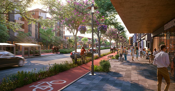
busy street with apartments, trolley, bike lanes, pedestrians and a dog
Is the world ready for 1st Avenue E to look like this?
(Swiped from hdrinc.com; used without permission)

(7/01/2024) The closure this month of the 1st Avenue Hy-Vee and Via Sofia's Restaurant has drawn attention to the perennial low performance of this historic street that slices between the Mound View and Wellington Heights neighborhoods. Without these two anchors, 1st Avenue might now be said to be in a state of crisis.

empty restaurant building with "coming soon" sign
1125: Via Sofia's has closed, but new tenants are coming, possibly soon

Perhaps co-incidentally, the City of Cedar Rapids is undertaking to create a plan for 1st Avenue East from 12th Street (location of Via Sofia's) to 17th Street (one block above Hy-Vee). The street was developed over a hundred years ago, and still bears the signs of being a neighborhood market street. Unfortunately, since then, the surrounding area has been emptied of population, especially below 14th Street, while 1st Avenue has been widened to a five-lane highway that carries 17,000 cars per day through this stretch. Auto-oriented development has not been good for a street built for walkable neighborhoods: The population within a walkable distance has declined, while the cars whizzing through have trouble finding places to park.

Here is an extreme but real example: The side of 2nd Avenue pictured below...

vacant lots on 2nd Ave
1246 2nd Ave SE: vacant church next to vacant lots

...had 71 people living on it between 12th and 13th Streets in 1953, according to Polk's City Directory. Today that number is zero. Extend that story over the whole area between 15th and 5th Streets SE and you can see what happened to neighborhood retail. 

1st Avenue near downtown is worth the city's attention. Even in its current forlorn state, it's outperforming the big box stores on the edge of town.

FINANCIAL PERFORMANCE, 2020-24

(compare to NE side Wal-Mart taxable value $534,981/acre)

NAME

ADDRESS

ACR

ES

TOTAL TAX VALUE 2020

VALUE PER ACRE 2020

TAXES EST

 2020

TOTAL TAX VALUE 2024

VALUE PER ACRE 2024

Cafe Allez & 237

111 13th St SE

0.193

248,200

1,286,010

9,328

207,800

1,076,684

Via Sofia’s

1119 1st Av SE

0.193

398,500

2,064,767

14,977

413,200

2,140,933

Wendy’s

1314 1st Av NE

0.771

1,424,100

1,847,082

49,996

1,454,300

1,886,252

Poppa& Tommyz + apt

1323 1st Av SE

0.289

384,000

1,328,720

13,118

387,000

1,339,100

Arby’s

1417 1st Av SE

0.386

654,200

1,694,819

22,967

720,300

1,866,062

College Commons + apts

1420 1st Av NE

0.874

3,301,000

3,776,888

98,747

4,143,700

4,741,076

McDonalds (closed)

1530 1st Av NE

1.200

1,329,000

1,107,500

46,658

1,090,300

908,583

Finding a formula that works for 1st Avenue near downtown would definitely help sustain the adjacent neighborhoods; if it continues to deteriorate, it will drag them down and create a desolate zone in the core of the city.

Grand Boulevards

face shot of Peter Calthorpe
Peter Calthorpe (swiped from hdrinc.com)

Last month, at the Congress for the New Urbanism, keynote speaker Peter Calthorpe described his idea of grand boulevards, and this might be a solution for 1st Avenue. Grand boulevards are commercial corridors developed with multifamily residential units and served (at least eventually) by public transit. He pitched it as a solution to the housing shortage more than a solution to declining corridors, but it is reported we do need more housing, and anyhow implementation of grand boulevards requires a declining commercial corridor in which to implement them.

closed restaurant with closed grocery store behind it
1530: Closed McDonald's by closed Hy-Vee

(Cedar Rapids residents will at least be familiar with Calthorpe's firm, HDR, which designed the trails on Mt. Trashmore near Czech Village.)

Peter Calthorpe and slide
Calthorpe's presentation at CNU: more focused on housing shortage than under-performing streets

Calthorpe envisions mid-rise buildings with about 100 units, so fairly large, mostly market-rate with maybe 15 percent reserved for affordable prices. (Too high a percentage discourages developers.) As much as missing middle and accessory dwelling units are steps in the right direction, the grand boulevard concept is the only way to get a lot of buildings at scale with private financing. (Governments can't afford to subsidize all the housing that needs to be built, he says.)

Kingston Pointe Apts, 515 2nd Av SW
Kingston Pointe, 515 2nd Av SW, has 18 units on half an acre, but we could go a good bit denser
Ashton Flats, 217 7th Av SW
Another model: Ashton Flats, 217 7th Av SW

The 1st Avenue Grand Boulevard

About 3250 feet worth of 1st Avenue is under study from 12th to 17th Streets, or a total of 30 acres on both sides of the street. If half of that territory is available for redevelopment, that would mean 900 or 1000 dwelling units (at 60+ per acre), which could be like, what, 2500-3000 residents? (Note that I'm not counting potential properties on A and 2nd Avenues, or farther up 1st.)

closed office building
1225: long-vacant office building on lonely block across from Coe College campus

EZ Pawn, 1344 1st Av NE
1344: Not picking on anyone's business, but this close to downtown?

2500-3000 new people living along 1st Avenue will generate more foot traffic for businesses.

1271: Opening of Cafe Allez has been attended by long frustrating delays

These people would need a lot of groceries, for one thing. Their presence on the street would reduce car speeds and crime while increasing liveliness (which can only help attract students to my former employer, Coe College). They would improve the current demand for public transit. "Once you've got a ribbon of development," says Calthorpe, "You can backfill transit along the way." 

Transit available to backfill includes the #5 bus along 1st Avenue, which already runs every 15 minutes, and could be extended to evening service; there could also be a north-south route, say an enhanced route #6, connecting Wellington Heights (and Oak Hill Jackson?) to the Coe and Mt. Mercy campuses up to commercial districts to the north.

Passengers wait for the #6 at Coe College bus shelter, November 2022:
the bus stop for the #5 on 1st Avenue is visible in the background
(Google Earth screenshot)

Constructing all these apartments creates questions about parking (where and how much?) and driveways (open to 1st Avenue or side streets?). I think these are important but resolvable questions. For the record, Calthorpe wants no minimum parking requirements, but that's not the same as no parking at all.  Anyway, the conversation should start with how we want to live, not where we are going to park.

1st Avenue is also a state highway (Business US 151 & SR 922), so civilizing the street itself to slow cars and encourage cycling and walking will require cooperation with the Iowa Department of Transportation. Alexandria, Virginia was able to work this out for King Street, and IDOT is trying to narrow highway right-of-ways through other towns, so I'm encouraged to hope they'll work with us.

SEE ALSO

"Crossing Cedar Rapids' Busiest Intersections: 1st Avenue," 8 August 2023

Martin Pedersen, "Peter Calthorpe Has a Plan for Building More Housing in California," Arch Daily, 7 April 2023

Robert Steuteville, "Grand Boulevards Would Solve the Housing Crisis, Peter Calthorpe Says," Public Square: A CNU Journal, 24 June 2024

Calthorpe's 2017 TED talk, "Seven Principles for Building Better Cities" (14:21)

Tuesday, August 8, 2023

Crossing Cedar Rapids' busiest intersections: 1st Avenue

cars on a wide and busy street
Looking up 1st Avenue from 6th Street W:
The wide street bisects mixed use areas with no safe place to cross

(8/8/2023) 1st Avenue is unique among the busiest streets in Cedar Rapids because it is not a stroad at the edge of town, but rather plunges straight through the city center. It is the spinal cord of our street network, abutting some of the city's oldest neighborhoods and its best pedestrian infrastructure. It has been the main drag since before there were cars. It was U.S. 151 until 1989, when it became Business Route 151 (Hancock). It draws a lot of vehicle traffic because there really is no alternative street for getting across town; no parallel street to 1st goes for more than a few blocks. Its high vehicle load, frequently turning from side streets or parking lots, and wide design (usually five lanes), create dangerous challenges for pedestrians. I've had a couple of close calls myself. 

[At about 18th Street West, the thoroughfare switches onto Williams Boulevard, while 1st Avenue winds through residential neighborhoods for another five miles. We, however, will be looking at the biggest oldest stretch of 1st Avenue through the core.]

Urbanist planner Sean Hayford Oleary asked on streets.mn: Why does walking feel so intuitive when we're in a city built before cars, yet as soon as we return home, walking feels like an unpleasant chore that immediately drives us into a car? He responds to his own question: We don't design the pedestrian experience for dignity. It is hard to find dignity along much of 1st Avenue, and quite a few stretches don't even feel safe to walk along or cross. The city has added some helpful crossing treatments in spots, but others remain problematic. It is not a street I will frequent when my mobility declines.

The title for Oleary's piece for streets.mn begins "If We Want a Shift to Walking..." Do we, though? A wide street carrying most of the vehicle traffic through the center of town is by definition going to be a challenge to cross. And it is quite the challenge, pretty much all along the route, except maybe on Sunday mornings. Past decisions have left us with a series of dilemmas along 1st: how to accommodate both people who use this as a thoroughfare for vehicles, and people in adjacent neighborhoods who need (loaded word, I realize) to access schools, grocery stores, and such across this dangerous street.  

Starting on the east side, where I have lived all these years, and with which I am most familiar...

trail underpass

30th Street trail underpass. This was part of a major reconstruction of 1st Avenue a couple years ago. The CeMar Trail will eventually connect Cedar Rapids and Marion, but can also serve as a way for nearby pedestrians to access Walgreen's drug store on the south side or Arthur (soon to be Trailside) Elementary School on the north side, for example. 

27th Street. There used to be an overpass here, originating I think to accommodate students walking to Arthur School. Did it get used, or was it too cumbersome to tempt people away from scooting directly across the street?

21st Street/Cottage Grove Avenue. A wide sidewalk was recently added to connect Washington High School, Franklin Middle School, and the CeMar Trail. There's another traffic light at 19th Street, on the other side of Franklin. But it's a long way from 21st to 19th, more than the implied 0.2 mile, and 20th Street is what Franklin is actually on. Crossing there could definitely be improved.

19th Street SE approaching 1st Avenue
Crosswalk across slip lane merging 19th Street SE
onto 1st Avenue (Google Earth screen capture from 2021)

19th Street. We're getting into some serious core now. 19th Street SE forms the eastern boundary of Wellington Heights, while 20th Street NE forms the eastern boundary of Mound View. Crossing is made more dangerous by the slip lane moving traffic from 19th Street SE onto 1st Avenue. On a brighter note, 1900 1st Avenue is slated to be a Dunkin' Donuts, which is less pedestrian unfriendly than the gas station/convenience store proposed last year.

grocery store parking lot across busy street
Park Court at 1st Avenue, July 2014

16th Street/Park Court. 16th Street NE has the traffic light where it ends in a t-intersection with 1st Avenue, next to the Hy-Vee grocery store which was slated to close in 2000 before $1 million from the city kept it open to serve the surrounding neighborhoods. The city missed the chance back then to move the storefront to at least one of the streets, and to rectify the pedestrian crossing at 1st which frustrates drivers and pedestrians alike. (On the southeast side, both 16th Street SE and the much-traversed Park Court end at 1st Avenue without crossings; pedestrians are directed to the traffic light half a block away, which not all of them follow. In 2020 I proposed rerouting 16th Street to give people coming from the southeast side a straight shot to the grocery store.)
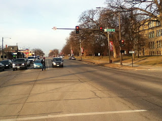

crossing-eye view of six lane street
College Drive/13th Street E, April 2014
crossing-eye view of five-lane street
Removing one-left turn lane in 2021 improved traffic flow
and pedestrian safety (Google Earth screen capture)

13th Street/College Drive. Both crossings by Coe College have been considerably improved, though they remain risky. Before 2021 there were two left turn lanes on 1st, dating I think from the time before I-380 when traffic was routed onto certain two- or three-lane one-way streets (including the street that is now College Drive). It's still a long way across 1st Avenue from campus to the apartments or the cafe on the corner (opening soon!), but there are fewer rows of cars to cross, and since left-turning cars can now turn at any time during the green light instead of having to wait for the green arrow, the drivers are likely to be less desperate.

cars approaching intersection
Coe Road/12th Street E, September 2013

12th Street/Coe Road. At 12th, where Coe sits across from Casey's convenience store and Via Sofia's restaurant,...

intersection with crossing buttons
Coe Road/12th Street E, July 2023

...the right turning radius has been tightened, and a walk button and striped crosswalk have been added.

10th Street. This is the main street of the MedQuarter, with medical facilities on both sides of 1st Avenue, and has a bus stop and some fine-looking crosswalks. A car came at me in one of those crosswalks a few weeks ago, and I had to scramble out of the way. A police officer saw it all from his car. I made eye contact. The officer made eye contact. Later I found out it's not technically against the law to nearly-hit someone.

8th Street and 7th Street. Twin one-way streets that are the main ways to access and egress I-380 from the east side of downtown. Wherever you cross this intersection, be extra careful, especially when crossing right-turn lanes.

crosswalk with motion sensors
4th street trail crossing, May 2014

4th Street. This is where the Cedar River Trail crosses 1st Avenue near downtown, right by the hotel/entertainment complex the city bought ten years ago. I have never been comfortable crossing here, but recent work has definitely improved it. 

4th street crossing now
4th street trail crossing, May 2023

There are more and better flashing lights, now at driver's eye level, and there's a median in the middle of the street so you're not taking on all four lanes at once.

building construction project
1st and 1st project under construction

1st Street W. The Kingston area on the southwest side has seen explosive development since the 2008 flood and subsequent. Land that had been cleared for a casino is being developed as a hotel, brewery, pickleball court. Other attractions, unfortunately including the inevitable casino proposal, may follow. This intersection is likely to be quite the hotspot, particularly if we anticipate people visiting more than one place. A key crossing light has been added between 1st and 3rd Streets W for when pedestrians can access this area again.

multifaceted intersection
L Street NW spills off the highway and onto 1st Avenue
(not pictured is a really nice sidewalk on that side of 1st,
leading to that intersection)

3rd Street and L Street. Twin one-way streets that are the main ways to access and egress I-380 from the west side of downtown. Wherever you cross this intersection, be extra careful, especially when crossing right-turn lanes.

church across large intersection
a wee median but no crosswalks by St. Patrick's Church, 5th Street W

5th Street. Past the interstate 1st Avenue is back to cleaving older neighborhoods, on this side the Taylor Area in the southwest quadrant and Time-Check in the northwest. As on the east side, crossing from one neighborhood to the other is serious business I would not encourage either an 8-year-old or an 80-year-old to undertake. 1st Avenue got some serious working over between the river and 6th, but there will still be six lanes in front of this parish church--seven on the other side of 5th--without much help to cross them.

buildings across intersection
crosswalk at 6th Street W

6th Street. For many years 6th Street has been a main thoroughfare through the near southwest side--it goes all the way to Coralville!--but a short side street on the northwest side. Most excellently, the city has just punched it through to connect with Ellis Boulevard NW, which should lead to some good things. It will be interesting to observe the evolution of this intersection. There are a bunch of small restaurants and bars around here, as well as some ethnic groceries, that could benefit with more pedestrian traffic, but that will only happen if it's safe to walk.

10th Street. This is the first traffic light above 6th Street. The intersection features a Family Dollar, a Kwik Shop convenience store, and a bar called Gilligan's. The corner lot next to Gilligan's has been vacant since shortly after the flood. Above 10th, 1st Avenue is mostly residential.

13th Street. 13th Street NW was disconnected from 1st Avenue a long time ago and made a dead end. This is where 1st and 3rd Avenues come together, which may be complexity enough for one intersection. Traffic from downtown sweeps off 1st onto 3rd, which is a crossing hazard.

15th Street. The old Lincoln Highway briefly used 1st Avenue from 13th to 15th Streets, then went through the northwest side on Johnson Avenue. This intersection provides access across 1st to the Johnson Avenue Hy-Vee, Roosevelt Middle School, Cleveland Elementary School, Veterans and Kingston Stadiums, and Cleveland Park.

1st Avenue presents the same mobility dilemmas as our exurban stroads, but more intensely. There are more people living near 1st Avenue, and there should be. There are all manner of places for non-drivers of all ages to go, close enough to access by foot, bicyle, or wheelchair. The core of any city is its most critically important area, and where walkability is not only desirable but historically baked into the design. I keep seeing this quote attributed to former Milwaukee mayor John Norquist: A city is where people come to work, raise families, spend their money, walk in the evening. It's not a traffic corridor. 

Yet there's a reason 1st Avenue carries 20,000-25,000 cars a day, and they aren't just going to disappear.

SEE ALSO: 

"What is a 'Stroad?'" 3 April 2014

"Figuring Out a Dangerous Intersection," 24 September 2013

"Walking Down to the Edge of Town," 2 August 2013

Week Without Driving Diary (III)

A very walkable block! For most of its one mile length, Washington Avenue SE is the very model of a walkable residential street. It's a ...