Showing posts with label trails. Show all posts

Thursday, November 21, 2024

Happy Trails 2024-25


signs on trail
The CeMar Trail is ready to be connected!

Linn County Trails' cheery Facebook post today serves a reminder of Cedar Rapids's ever-improving trails network. Many of these projects fix connections at a specific location, but by the end of next year there will be some dramatic changes apparent to even the most casual trail user (cf. Peffer 2024). 

Linn County Trails Facebook post listing 2024-25 projects

Arguably the most dramatic will be the completion of the CEMAR Trail between Cedar Rapids and Marion, filling the gap between Mt. Cavalry Cemetery and Route 100. (See the map that accompanies LCTA President Tom Peffer's message this month.) I don't know if it will make it faster to go between the two central business districts by bicycle than by car, as someone suggested when this was still a gleam in our eyes, but it will be a game-changer--in a good way, I hasten to add, for anyone who knows how much I hate that term under normal circumstances.

Currently the Cedar Rapids portion ends at 3rd Avenue and 33rd Street Drive SE, by the Mt. Calvary Cemetery:

end of paved trail near street intersection, trees
33rd Street Drive approaching 3rd Avenue SE
 

It's hard to see between the house and the cemetery, but there is a strip of public land there where the trail will continue. Looks like construction has begun across Indian Creek!

path between trees in distance beyond earthen berm
View of trail-in-process from the cemetery
grave markers with seats facing creek and trail
Graves near the creek afford view of the trail

On the Marion side, the trail ends just north of Highway 100, in the shadow of Menard's:

knocked over barrier sign, highway in background

There is a spur just there that connects to the west end of Grand Avenue:

unpaved trail approaching street and houses

The Bowling Street Trail is one of the oldest in Cedar Rapids, and it was showing its age back in 2015 when Brandon Whyte took the MPO Ride down there. It's now improved and longer, running from 20th to 33rd Avenues SW, thereby connecting Czech Village to points south, including the Wilson Avenue Hy-Vee Food and Drug Store. 

trail with deceptively nasty pothole, 2015
Bowling Street Trail pothole, 2015
wide concrete sidewalk at top of hill, church in background
2024: New year, new surface!
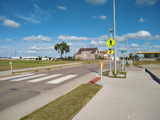
signs and flashers for pedestrian crossing
Several pedestrian crossing signals were added as well

The trail continues on the old macadam surface south to 50th Avenue, becoming an eight-foot sidewalk over U.S. 30 before it diminishes to six-feet approaching Kirkwood Community College.

Other trails updates for commuters:

  • The Cherokee Trail will get another 1.7 miles longer, extending east as far as 13th Street NW, so getting people about a mile or so from downtown on what could become a key east-west artery.
  • The Edgewood Trail will add 1.1 miles north from the Cedar River to Town Center Drive. It has the potential to be a key north-south artery, particularly once the new west side library opens. 
  • The Cedar Valley Nature Trail will add a 1.7 mile loop from 7th Avenue SE (where the current trail goes onto the street) to the Lightline Bridge project south of Czech Village. 
  • I don't see anything about connecting the Lindale Trail to the CVNT, though; is that still in the works? [LCTA responds: Hopefully construction will begin in 2025 but... the City is awaiting a response on a final appeal to the Railroad for [the preferred alignment along the railroad right of way between Center Point Road and Council Street]. Should the Railroad consent, the project can proceed. If not, the alternative alignment along Council Street and 51st Street... will need to be developed. As such, the timeline is currently indefinite.]
  • The LCTA newsletter also includes plans for a capital campaign for future trails, including building the Interurban Trail to Mt. Vernon

Why This Matters

All this trail development is enough to make an urbanist giddy, so it's good for our mental balance that Pete Saunders's Substack today references a pandemic-era post by Alissa Walker, who found much of urbanism, even at the height of COVID, to be blithely indifferent to the social inequality that mars our cities (and our whole country, really):

If the coronavirus has made anything clear, it's that cities cannot be fixed if we do not insist on dismantling the racial, economic, and environmental inequities that have made the pandemic deadlier for low-income and nonwhite residents. Yet many prominent urbanists have simply tweaked the language from their January 2020 tweets and fed them back into the propaganda machine to crank out COVID-tagged content, perpetuating the delusion that all cities need are denser neighborhoods, more parks, and open streets to magically become "fairer." (Walker 2020, citing Wigglesworth 2020 for COVID data)

Maybe in 2020, we should replace Walker's reference to "pandemic" with "road deaths," "housing instability," "deaths of despair," or "trouble with the law," but the concern remains a valid one. An Urban Institute study found 52 percent of Americans living below the "true cost of economic security," with 12 percent living below 75 percent of that threshold (Acs, Dehry, Giannarelli, and Todd 2024). Will better bicycle infrastructure significantly assist with such widespread struggling? We simply don't know. A couple years someone around here--I can't remember if it was the City of Cedar Rapids or somebody else--surveyed trail users. It was a convenience sample, and it skewed heavily male and upper income. (It's difficult in Iowa to oversample whites, but it managed to do that, too.) So when it comes to making our cities more equitable, we are literally groping in the dark.

That having been said, and with the understanding that even the best trails aren't going to magically fix social injustice, I think a lot of this trail development will improve equity, simply because the trails are  becoming as functional as they are fun. We are gradually building a network that facilitates safe, inexpensive commuting to work, school and shopping all over town. And that's definitely worth celebrating!

cyclist rides ramp to 606 Trail near Western Avenue, Chicago
Chicago's 606 trail serves bicycle commuters and school children,
as well as recreational walkers and joggers

Wednesday, September 14, 2022

More Cemar Trail Progress!


wide sidewalk crossing street
As exciting as Promontory Point must have been,
the Cemar Trails joins existing trail near 29th St and B Ave NE

The Cemar Trail, which will eventually be a seven-mile direct route from the center of Cedar Rapids to the center of Marion, has made an important connection to the broader trail system in town. The trail under the bridge at 1st Avenue East has been completed...

wide sidewalk with spur going under brick bridge
Note also connections to wide sidewalks on
both sides of 1st Avenue

...and joins a completed spur by Arthur School. 
wide sidewalk, perpendicular to crosswalk with signal
Crossing 29th Street by A Avenue

The previously constructed portion of the trail runs along an old railroad right of way to 16th Street; from there it's not terribly difficult to connect to the Cedar River Trail by Cedar Lake. (See Linn County Trails Association map here.) For the record, there are a couple of awkward junctures on the way: 
  • at the edge of Daniels Park, where H Avenue meets Oakland Road, the trail rather dumps you into traffic, but it looks like crossing at the sidewalk might be an alternative
  • from there it's bike lane to Cedar Lake, which can involve some negotiation with traffic entering and exiting I-380 (my solution, to take the interstate down, might be too radical for some)

From there you can go a long, long way, to Elk Run Heights near Waterloo to the north, and to Solon to the south. Eventually you can go ever farther; it's part of the Great American Trail project.

Meanwhile, in the direction of Marion the Cemar Trail still stops at 3rd Avenue and 33rd Street SE, adjacent to Mount Cavalry Cemetery. 

gravestones and trees

Marion's completed its portion as far south as Highway 100, so there's just 1.3 miles to be built, with completion expected in fall 2025 (Warner 2022). Iowa Governor Kim Reynolds just announced a Destination Iowa award of $3 million to Marion towards completion of the trail as well as a plaza planned for Uptown. (The Destination Iowa program is funded by federal COVID relief funds; such is the condition of American government in 2022.) The City of Marion recently announced trail construction “will begin after easements have been obtained and construction of a sanitary sewer trunk line is complete.” 

I wonder if this modest apartment building...

Doorway to brick apartment building
293 34th St Dr SE

...can then publicize and monetize its proximity to the trail network!

SEE ALSO: "Cemar Trail Progress!" 21 August 2021

HISTORIC CEMAR TRAIL RIDES!

"Cemar Trail," My Green Misadventure, 9 October 2011

Cindy Hadish, "Reconstructed Railroad Bridge Connects to Past as New Trail Link in Marion," Homegrown Iowan, 12 July 2021

Joe Sheller, "In Which Miles Total 356 for ARTN(a)R," CR Biker, 26 July 2020

Wednesday, August 11, 2021

Cemar Trail progress!


Trail connects to 33rd St Dr SE near 3rd Av

Laozi, who may or may not have actually existed, may or may not have said that "A journey to Marion begins with a single step." You can now take that step on the southeast Cedar Rapids portion of the CeMar Trail! (See the route on the Linn Country Trails map here.)

Crossing 32nd St Dr SE
(32nd St Dr is not to be confused with 32nd St SE, which is 
in a completely different part of town)
Approaching Raining Rose.
Who can cling to a raining rose?

The Cemar Trail will eventually--LCTA estimate is 2023--connect to a long-standing trail through Marion, and will arguably make the bike trip between the downtowns faster than the car trip. 
Approaching 1st Avenue and 30th St Drive SE

You can go under this bridge, but you can't go through it... yet. 

When the bridge under 1st Avenue is open, you can ride all the way to Cedar Lake (with some on-street bike lanes as you approach the lake.) Eventually, the connections will lead all the way to the Mississippi River!

SEE ALSO:
Kea Wilson, "Protected Bike Paths Saved Lives During COVID," Streetsblog USA, 10 August 2021

Thursday, November 1, 2018

Trails opened, trails in the works, and other Corridor biking news

Cycling in the Corridor is being celebrated as summer turns into fall, with more infrastructure and increased levels of participation, in spite of enduring more than our share of foul weather.

On August 26 the last leg of the Cedar Valley Trail was opened, from downtown Ely to the Johnson County line.
Trail displays and guides were provided by the Linn County Trails Association

Not quite finished: intersection of  Ely and Seven Sisters Roads

Posh new bridge

Where it ends, for now

Eventually, the trail will connect to the Hoover Nature Trail in Johnson County, which extends all the way to the Quad Cities


Access to Lake MacBride State Park and the town of Solon will be via this roundabout:

There was some rain on the ride, inevitably, but not enough to throw it off.

The same cannot be said for the annual Mayors' Bike Ride on Labor Day.

The forecast called for heavy rains with thunder, forcing its cancellation. There was a lot of rain that weekend:

So we had to be content with recalling Labor Days of yore.
A dry and sunny Mayors' Bike Ride in 2015

More rain later in the month both delayed completion and forced postponement of the scheduled September 30 opening of a new stretch of the Grant Wood Trail near Marion. The Cedar River got above flood stage three separate times...
3rd Avenue bridge, 25 September 2018

...forcing closure of some other trails, but unlike 2008 there was no major damage. Phillip Platz, astute urbanist in charge of communications for the Linn County Trails Association, promises a ribbon cutting ceremony and opening ride soon.

There's no questioning public interest in trails, particularly after the extraordinary turnout at a late October forum on how a ped-bike trail included in the Tower Terrace Road project will interface with Interstate 380, where there will be a new exit constructed in the next few years.


Tower Terrace Road will be gradually improved, to accommodate current congestion and anticipated future growth, from Edgewood Road to Route 13.

Given current rates of funding, that will take approximately 30 years to complete! However, the exit off the Interstate is of highest priority and is expected to happen soon.

Current plans call for at-grade crossings across exit ramps.


An alternative proposal is to route the path through a tunnel to avoid cross-traffic.
 
The alternative is somewhat more expensive--maybe $500,000 on top of an $18 million project--but the attendees appeared strongly supportive. I agree... the additional cost is marginal, and would ensure the path got used. It will be a cool way to get from Marion and the northern parts of Cedar Rapids to Wickiup Hill Park, but only if people feel they can safely ford the highway.

Wednesday, May 4, 2016

Thinking big in Cedar Rapids


Representatives from two groups planning substantial projects designed to benefit the City of Cedar Rapids appeared at a 1 Million Cups event Wednesday morning, which by possible coincidence was also the 100th anniversary of the birth of ur-urbanist Jane Jacobs (1916-2006).

Jacobs's best-known work is her 1961 book The Death and Life of Great American Cities, which has inspired many an urbanist. She wrote it while living in New York, part of her resistance to uber-planner Robert Moses's uber-plans for the city which involved leveling large parts of her neighborhood, Greenwich Village. She argues, based on extensive observations, that what contributes to the life of cities is an organic type of development that emerges over time from countless individual actions and interactions. The grand schemes of urban planners, however well-intentioned, often contribute to cities' death by creating barriers to life-sustaining interactions like wide streets, massive housing projects, and parks that are isolated and scary.

It's a long book, and a complex argument, but very readable, and apart from a few archaisms very contemporary. If you haven't read it, you should, and what better day than her 100th anniversary to make that resolution?

Jacobs's vision has inspired many an urbanist, whose tasks now are not so much to protect vibrant but threatened urban neighborhoods but somehow to bring back to life places that have suffered from the suburban model of development. In Cedar Rapids, as in towns across the land, the inclination is to jump-start life through "home run" style projects that promise instant (and surely inflated) job creation, along with attractive amenities and, heaven help us, green space. Up-front costs to government are sold as WORTH IT, and long-term infrastructure costs are ignored. The new Westdale Mall is an infamous local example; the downtown casino project that was nixed by the State of Iowa seemed like another; and I'm dubious about the baseball complex and the waterpark planned for different edges of town.

David Tominsky introduces the speakers
The two projects presented Wednesday are more modest in scope, and promise not so much heroically to save the day as to facilitate the re-creation of those connections that Jacobs said sustained the life of the city. A lot depends on how they are carried out, and so, standing firmly on both sides of the fence, I present optimistic and pessimistic scenarios for each. In doing so, I assume as many have argued (see Smith, cited below, for a recent example) that the future of the city lies in reinhabiting its core and not in low-density development at the edges.

MedQuarter


What: 55 square blocks east of downtown, governed by a Self-Supporting Municipal Improvement District, bookended by two hospitals. Hospitals, clinics and assorted other businesses currently employ 8000 people. And parking. A great deal of parking.
The current MedQuarter; parking areas in gray
Goals: To become a nationally-recognized medical destination, on the model if not the scale of Rochester, Minnesota. To leverage the medical assets into commercial, neighborhood and workforce development.

Optimistic scenario: Development creates an important connection between what's happening downtown and in New Bohemia and the core neighborhoods of Oakhill-Jackson and Wellington Heights. This proves a source of sustenance for downtown and New Bo. Work force housing gets built. Expanded employment opportunities create vibrant, diverse neighborhoods that in turn sustain street life and local businesses. Maybe even: Density gradually replaces the current ridiculous oversupply of parking, while visitors are accommodated by local circulator buses that provide easy transportation between clinics and other local sites.

Pessimistic scenario: The big boys--the hospitals and Physicians Clinic of Iowa--get the space they want to expand. Nothing else gets done, because there's no institution desirous or capable of carrying it out. With priorities on security and adequate parking, the area continues to be a barrier between downtown and core neighborhoods--which then continue to suffer from disinvestment and lack of opportunity (arguably worse than gentrification). The greenway along 4th Avenue, created by clearing out older housing, is never used because there's no place to go. The banners fade, and someone realizes "in the Q" means "standing in line."

Destination Cedar Rapids
Much of these developments are planned for areas that were flooded in 2008
What: Coming together of multiple projects along the Cedar River, including development of Cedar Lake, the 3rd Street Corridor downtown, recreational development of the former Sinclair Meatpacking property, and Czech Village, planned over the next five years. Specific projects include reconstruction of a rail bridge across the river south of New Bo for recreation, development of housing and shopping east of New Bo, and a multi-use park at the end of 3rd Street.

Goals: To promote Cedar Rapids as a tourist-recreational destination, where residents and visitors can have a "Wow" day. In the words of former Parks Commissioner Dale Todd (below), one of the presenters on behalf of the project, "This community has to grow. We can no longer be where we're at."

Optimistic scenario: The single brand provides some synergy to the different projects, and helps them all get done. These developments attract businesses and families to the city center, and the density helps sustain a vibrant core. The park adds an important feature for young families who are currently not well-served by downtown, and helps spur housing growth. Infill growth helps make city services more efficient, adding to the general satisfaction. Future floods do minimal damage, thanks to far-sighted design.

Pessimistic scenario: Efforts to provide "Wow" days overlook the organic growth needed to sustain the area over time. Cooperation that looks good on paper is harder in practice, and gives way to rivalry. At least some projects get done, but return on investment falls well short of substantial costs. People agree that the projects are nice places to visit, but prefer to live elsewhere. Eventually they find some other, newer cool places to go. The banners fade, businesses close, projects age, and start to look dowdy.

The Med Quarter and Destination Cedar Rapids plans are at a reasonable scale. How they play out depends on whether the private interests supporting them are compatible with the overall good of the city, and how well they contribute to organic development as opposed to being ends in themselves--in other words, how well they fit into Jane Jacobs's vision of what sustains life in a city.

SEE ALSO:
 Thomas Campanella, "Jane Jacobs and the Death and Life of American Planning," Places, April 2011, https://placesjournal.org/article/jane-jacobs-and-the-death-and-life-of-american-planning/
 Nolan Gray, "Who Plans? Jane Jacobs' Hayekian Critique of American Planning," Strong Towns, 4 May 2016, http://www.strongtowns.org/journal/2016/5/2/who-plans-jane-jacobs-hayekian-critique-of-urban-planning
 Story Hinckley, "Jane Jacobs: What Would the Urban Visionary Think of U.S. Cities Today?" Christian Science Monitor, 4 May 2016, http://www.csmonitor.com/USA/2016/0504/Jane-Jacobs-What-would-the-urban-visionary-think-of-US-cities-today
 Noah Smith, "Want Economic Growth? Try Urban Density," Bloomberg View, 3 May 2016, http://www.bloombergview.com/articles/2016-05-03/want-to-boost-economic-growth-empty-the-suburbs

Sunday, July 12, 2015

Chicago: Bloomingdale Trail and Bucktown


This week marks the first "monthiversary" of Chicago's Bloomingdale Trail, also known as the 606, which opened with great fanfare and no coincidence on June 6. It's a high-trestle trail, constructed along abandoned railroad tracks, running east-west for 2.7 miles on the west side of Chicago. As can be seen on this map, it runs alongside Bloomingdale Avenue (1800 N)--hence the name--between Ashland (1600 W) and Ridgeway (3750 W) Avenues. No doubt it was inspired by New York's High-Line Trail. 80,000 people live within ten minutes' walk from the trail.

We walked on the morning of what would become a hot, humid Monday. The trail was well-used by people of all ages and physical conditions--mostly pedestrians, with some cyclists. My friend Mary Scott-Boria, who lives nearby and is a tireless evangelist for the trail who has been on it at least four days a week since it opened, reports it gets more crowded towards mid-day and stays so well into the evening. Use is particularly heavy on weekends. The trail seems mainly oriented to recreation, but it would give someone in Humboldt Park or Logan Square at least a start on their commute downtown.

The trail is nicely landscaped, with inviting entrances (here, at Milwaukee Avenue near the CTA blue line) :

...and this stylin' bridge over Milwaukee Avenue:

A more basic entrance, but handicapped-accessible, at Damen Avenue:

Maps are posted along the trail near major streets:

The east end of the trail is flanked mainly by condominiums...

...and (here) artists' lofts; about Rockwell Avenue the built environment switches abruptly to houses.

The trail seems to have stimulated development, or at least the search for synergy. If you lived here, you'd be home now:

There's a nice overlook of Humboldt Boulevard (the large Humboldt Park is two blocks south of the trail).

A number of public and private schools are convenient to the trail...

...and indeed we met a group from a summer school program on their way to the park for some fishing:

At the west end of the trail, near its terminus at Lawndale Avenue, there is a sort of curlicue track around a hill, which makes for an elaborate turn-around if trail users so choose.


Along with construction of the trail, four new neighborhood parks are being developed at street level. This is the play space at the enlarged Kimball Park:

Trees and shrubs are being planted along the trail--we saw numerous park district employees at work on various projects. This is clearly a project in which the City of Chicago is heavily invested, but I expect the amount of effort needed to keep the plantings watered and weeded is not sustainable by the city alone. The 606 website is soliciting donations through the Trust for Public Land; perhaps local outdoor organizations could also contribute volunteer efforts.

The trail begins at Ashland Avenue in the Bucktown neighborhood; west of Western Avenue it runs along the boundary between Humboldt Park and Logan Square. According to entries in the encyclopedic Chicago Neighborhoods and Suburbs: A Historical Guide, edited by historian Ann Durkin Keating of the esteemed North Central College:
  • Bucktown is believed to be named for goats that used to graze there in the 19th century. It was annexed to the city in 1863. After that it was a Polish working-class neighborhood, and now is gentrifying (Essig 117). Parts of this area are also considered parts of Logan Square, West Town and Wicker Park. For example, both Bucktown and Wicker Park lie between Ashland and Western Avenues. Wicker Park extends from Bloomingdale south to Division; Bucktown extends from North north to Fullerton. All of these areas south of Bloomingdale are within the official boundaries of West Town (Essig 117, Essig 301, Best 307). One's best approach as an Iowan is to smile and nod knowingly. I guess this is why we need banners.
  • Humboldt Park has been part of Chicago since 1869, and is named for the 207-acre flagship park, which in turn was named for Prussian naturalist Alexander von Humboldt (1769-1859). Then it was ethnically dominated by Danes, Germans and Norwegians; today it is primarily Dominican, Mexican and Puerto Rican, as well as African-American. In contrast to the condos of Bucktown, Humboldt Park is mostly small, single-family homes (Badillo 174-175).
  • Logan Square is more upscale than Humboldt Park, but also primarily Latino. It was annexed in three stages between 1863 and 1889. Milwaukee Avenue was once to be a farm-to-market road. It's a mix of single-family homes and apartments (Patterson 199-200).
The east terminus of the trail is in the clearly-gentrified Bucktown neighborhood, convenient to two establishments I'd been advised to check out. Ipsento Coffee, 2035 N. Western Avenue, near the CTA blue line, was named one of the twelve best independent coffeehouses in the U.S. by Culture Trip.

I can't comment on that level of comparison, but I can say the coffee was smooth and delicious, and the interior was cozy.

Decorative shelves built from books, including the autobiography of the notorious Donald Trump, were a quirky and creative touch.
 
Quimby's Bookstore, 1854 W. North Avenue, is near the Damen stop on the blue line.

They stock a variety of offbeat selections, including comics and zines by local authors. 
Quimby's is at press time the only place you can purchase It's Still Happening: A Sequel by Theora Kvitka.

We finished our morning in Bucktown with lunch at Goddess and Grocer, 1649 N. Damen.
 
BACKGROUND MATERIAL: Ann Durkin Keating (ed), Chicago Neighborhoods and Suburbs: A Historical Guide (University of Chicago, 2008). Entries by David A. Badillo ("Humboldt Park"), Wallace Best ("Wicker Park"), Steven Essig ("Bucktown" and "West Town") and Elizabeth A. Patterson ("Logan Square")

10th Anniversary Post: One Way or Two?

  Coe Road NE is two-way as of March 2025 Cedar Rapids undertook a number of ambitious street initiatives in the 2010s, including adding bik...