Showing posts with label Cedar River. Show all posts

Monday, June 3, 2024

10th Anniversary Post: West Side Greenway


trees, lawn, sidewalks
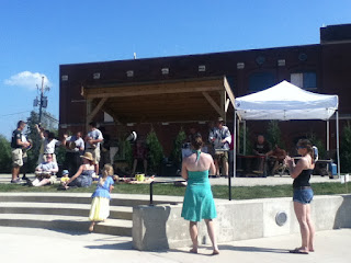
Time Check post-flood, June 2014

Ten years ago this month, the City of Cedar Rapids had an open house at the Flamingo Events Center on the near northwest side to discuss plans for a greenway along the river where some of the worst flood damage had occurred in 2008. The greenway would stretch from Ellis Park, one of the largest and oldest parks in the city, to Czech Village, about four miles in length. Some of the ideas that were floated at the time included basketball courts, one or two boat launches, disc golf putting green, an ice rink, and a ropes course, as well as improvements to the riverside bike trail. At the time I concluded: The special elements... will serve as "demand goods" [term I cribbed from Jane Jacobs], drawing people from all parts of the city and beyond. But the ongoing success of these projects depend on the ability of planners to coordinate effectively with neighborhood and commercial development.

2024: distant view of Ellis Flats, 1618 Ellis Blvd NW
across field planned for trail, water play, skate/skills park

Federal support for west side flood protection was not approved until 2018, and only last week did the City Council approve the final version of the greenway plan. The next step is fundraising from the federal government and other sources (Payne 2024). The plan is divided into short-term (next five years) and medium-term (next ten years) phases. 

The future impact section of the plan anticipates 1-2 million annual visitors to the parks, with the middle estimates projecting $250-500 million in new investment, $60 million a year in economic benefit, and creation of 1300 jobs (p. 86). (These numbers should be taken with a grain or perhaps a pillar of salt. Does anyone ever go back and check these numbers later?) 

grassy area with flood wall and elevated highway
1st St and 1st Av NW: plans for whitewater rafting course

parallel sidewalks between street and river
1st St and E Ave NW: plans for trail improvements,
Fallen Forest nature play area

Plans for the middle section ("Riverfront Park," discussed on pp. 59ff. of the plan) do not discuss its interface with the latest casino proposal. (See "Cedar Rapids Casino" 2022.) That may be prudent, because approval of the casino at the state level is by no means certain, but it's worth noting the current 1st Street NW will be rerouted and converted into a park road, and that the footprint of the park, particularly near the proposed nature play area and dog run, intrudes upon the footprint of the casino. This is fine with me, since I wish the casino would go far away, but if two would-be tourist destinations are to exist cheek-by-jowl in what used to be a residential neighborhood, it will require some thinking.

intersection, plastic fencing, grassy area
1st St and F Ave NW: dog run, parking for whitewater rafting... and casino?

wide street with cars, buildings in background
1st Ave at 1st St W: still a wide, high speed highway
through the center of town 

The chain of park areas provides a number of potential benefits to nearby neighborhoods; it will be interesting to see how these considerations are balanced with the expectation of being a tourist magnet. The Time-Check Park is adjacent to development along Ellis Boulevard NW as well as existing residential areas to the west. Ellis could be a challenge for small children to cross, but overall the park should be easily accessible on foot to a lot of people. 

house with anti-development signs
Not this neighbor, though: 1426 1st St NW (and others?)
stand in the way of the canoe safari and picnic grove

Ditto the gardens, water play area, toddler area, and roundhouse in the Czech Village Park on the southwest side. Its area also has planned residential redevelopment, existing residences, and a challenging through street (C Street SW, in this case). I hope there will be some routine play equipment for the littles, but the bigs ought to find more places to explore than in a typical city park. 

grassy area with houses in distance
approximate site of B St SW woonerf
plans for toddler park, water play, playground

Accessible green spaces that are somewhat wild provide benefits to individuals as well as the overall ecology (Galle 2023). This all adds to the attractiveness of the neighborhoods. In a best-case scenario, the neighborhoods would provide steady use of the parks, with folks from farther out adding their own energy without overwhelming things, and the city will be committed to ongoing maintenance and improvement.

The big question remains from 2014: Will the Greenway project be able to evolve along with the neighborhood, while accommodating visitors from elsewhere, like our city's flagship parks? Or will it be primarily a "destination," separated and alienated from the place where it's located, like the baseball stadium, New Bo City Market, and the proposed casino (though any of these may change in time)?

MAIN SOURCES

Marissa Payne, "Cedar Rapids Will Seek Funding to Bring Greenway Plan to Life," Cedar Rapids Gazette, 29 May 2024, 1A, 8A

Greenway Parks Plan Update (City of Cedar Rapids)

Wednesday, June 26, 2019

Bridging the bridge

In Czech Village, historic Sykora Bakery features pedestrian level windows and benches
[NOTE: Most of this essay was written before I saw a short item in today's Gazette reporting Sykora Bakery faces financial distress due to flood insurance premiums that are slated to double over the next three years. Substantial increases in premiums would be a game-changer for the district, and not in a good way. They would also render moot much of what follows.]

Czech Village and New Bohemia are two historic neighborhoods south of downtown Cedar Rapids. Since the 19th century, they were home to working people and their families--many of them recruited from central Europe to work in local factories like Sinclair Packing and Douglas Starch Works. The factories closed, and a lot of those homes were destroyed in the massive 2008 flood. Since then, government and private investment, along with an increased preference for urban living among young professionals and empty-nesters, have renewed the neighborhoods as walkable places with some interesting local businesses. (More on the history of the district here.)

The new condos notwithstanding, Czech Village and New Bohemia are mostly "drive-to urbanism," with businesses catering to people who live outside the district with bars, restaurants and specialty shops. The National Czech and Slovak Museum (current facility opened in 1995, moved to higher ground and reopened 2012) as well as the African-American Museum of Iowa (current facility opened in 2003 and reopened 2009) are nationally known institutions. For day-to-day needs, like groceries, pharmacies, hardware, and schools, residents of these districts must go elsewhere in the city. Auto traffic from elsewhere is accommodated with huge parking areas.

Source: Google Earth
Czech Village and New Bohemia share a common ethnic heritage, a contemporary identity as tourist destinations, and a Main Street organization: the Czech Village/New Bohemia Main Street District was created in 2009 to promote business development and historic preservation. Main Street also hosts events and sponsors building improvement grants. Abby Huff, a historic preservationist with previous Main Street experience, became the director of CVNB Main Street this year, following the long tenure of Jennifer Pruden, whose energetic leadership helped put the districts on a stable footing.

These synergies are limited by the semi-permeable barrier between them that is the Cedar River. The river is scenic, and is becoming less a potential menace as construction of flood protection proceeds. However, it is as wide as a large parking lot, which can create a disincentive to walk from one neighborhood to the other--at least enough to figure in most discussions of the district I've attended. To be exact, the 16th Avenue bridge is 228 steps across. (These are my steps. Your actual steppage may vary.)

Even from the outdoor tables at Kickstand Bike Bar, Czech Village seems a long way away
CityLab reported in 2015 on studies by Reid Ewing at University of Utah of factors affecting the choice to walk in New York City and Salt Lake City. The key factors in Salt Lake City were transparency, the ability of walkers to perceive human activity beyond the sidewalk (including busy buildings and parks, and a high proportion of windows), and imageability, something about the place that is distinctive and memorable (Bliss 2015, Jaffe 2015).

Cedar Rapids is close in size to Salt Lake City--population of the city proper is about 2/3 the size, though the metropolitan area is much smaller--so we'd expect the factors to be similar. New Bohemia (68) and Czech Village (71) have high Walk Scores, and score high on both of Ewing's dimensions.
So do newer stores like Soko Outfitters
On the New Bo side, the CSPS building houses Next Page Books and Frond Shop & Studio

Human activity in the outdoor seating area at Lion Bridge (Source: lionbridgebrewing.com)

Imageability: Clock tower by the bridge; behind it is the National Czech and Slovak Museum
Crowds gather for events at New Bo City Market
The bridge between them, the Bridge of Lions, constructed in 1910, is not uninteresting, either: it has periodic cutouts with benches and overlooks of the river. There's even human activity at times when people fish off the bridge.


Still, the river appears to be a barrier to pedestrian flow between Czech Village and New Bohemia. I expect it's mostly subconscious for most people. As City Lab writer Eric Jaffe points out, people don't choose whether and where to walk by "[s]tanding at a street corner calculating first-floor window ratios [which] would qualify as weird even by the outlier standards of New York City sidewalk behavior." Most people walk when and where they feel like walking--otherwise they walk somewhere else, or drive--and mostly those blocks turn out to be the ones with characteristics like the ones Ewing and his students identified.

The vast majority of people in Cedar Rapids, even those who frequent these trendy areas, get most places by driving cars. So it's easy to walk across 3rd Street from the New Bo City Market to get a beer at Parlor City, but walking over the river to Lion Bridge would never enter the mind as a conscious choice.

There are ways to make the barrier less superable. Attractions that are unique, or which somehow otherwise stand out as particular destinations, could prove impelling.
At 2nd St & 12th Av, Eduskate and 965 are one of a kind
The most obvious aspect of the barrier, though, is that neither side has built to the bridge. Recall that the Bridge of Lions is 228 Humble Blogger Steps (HBS) across. It is a mere 83 HBS from the bridge to Soko Outfitters on the Czech Village side, but 287 HBS on the New Bo side from the bridge to Little House Artifacts. Mad Modern might be marginally closer, but note well that it's farther from the bridge to the first non-bar attraction in New Bo than it is to get across the bridge. [Update: Mad Modern is closer to the bridge (233 HBS) than Little House Artifacts, but the distance to the bridge is still greater than the distance over the bridge.]

This is partly understandable, given the experience with flooding since 2008.

Sandbagging in New Bohemia, 2013
But the New Bohemia side carries buffering to an unnecessary extreme. The first thing you see coming over the bridge into New Bo is a vacant lot where there used to be a bar.
200 block of 16th Av SE: missing teeth? Punched in the mouth!
The next block in is also mostly vacant.
1300 block of 3rd St SE
Kickstand has opened across 16th Avenue since the South Side Tavern was taken down, and Little Bohemia and Tornado's are a little farther down, so maybe we don't need yet another bar on these blocks, but whoever owns this property needs to unclench their grip and let it happen. A small grocery would go far to making this area truly supportive of residences, and in turn the 24-hour life that would make real the vision of live-work neighborhoods on both sides of the river.

An alternative approach is to look at improving mobility across the river. Main Street Director Abby Huff likes to get across the bridge with the e-assist bikes newly available from Veoride.
Checking out the new bikes at the Market
Or, thinking way out of the box, a Sky Glider like they have at the Iowa State Fair!
https://c2.staticflickr.com/6/5593/14795164398_bf4cf3e07a_z.jpg
Sky Glider Lift at the 2014 Fair (Source: flickr.com)
Put one end in Lot 44 and the other at the Kosek Bandstand. Why should Des Moines have all the fun?

Music to accompany this post:

SEE ALSO: Ben Kaplan, "A New Bohemian's Guide to New Bohemia," Corridor Urbanism, 3 August 2018

Wednesday, June 20, 2018

CR Flood 10 Years On


Cedar Rapids celebrated the 10th anniversary of our cataclysmic flood by showing off the progress of the flood control system as well as the remarkable rebirth of flooded areas. Observances included the dedication of memorials in the Time-Check neighborhood...
north side of O Av

south side of O Av; clocks are set to 10:15 when the river crested

...an organizational fair at the Veterans Building...

...a tour of restored historic properties...
The Kurik House (1910s) was moved from 1024 to 1028 2nd St SE

The exterior and interior were painstakingly restored by Todd Sabin;
today it houses Baby Time and an upstairs apartment
...and bus tours of the flood control system, the restored Water Pollution Control Facility, and historic neighborhoods.

The flood control system, funded with a mix of federal, state, local and private contributions, combines a variety of elements: earthen levees, concrete walls, movable walls and pump stations, as well as one detention basin in New Bohemia.
The slab is for receiving snow from plows
In New Bo, half a mile has been constructed of what will eventually be a 7.5-mile levee.
Section of wall seen from across 16th Av at 2nd St
Other levees are or will be in Czech Village...
Construction underway near Bowling and C Sts
...and downtown (the "transformer" aspect of  McGrath Amphitheatre). Engineer Rob Davis, program manager for the flood control system, notes that the barriers are being constructed above "2008 volume," which means the level the river would have attained if it had been constrained by all the flood control--higher than it actually was when it was able to spread.
Sign at McGrath Amphitheatre marking 2008 water level
The city has also raised the height of its wells and communications equipment, and relocated utilities. The 8th Avenue bridge will be replaced in 2023, and elevated to allow people to get over the river, which was problematic in 2008 (and even in a minor flood event in 2016).

The city estimates the total project costs as $550 million up front, $750 million over 20 years, of which about half has been secured: "City leaders continue to develop ideas to determine a funding source for the City's commitment ($110 million) as well as additional funding gaps necessary to construct the entire system." Linn County voters defeated local option sales tax referenda in 2011 and 2012.

Ten years has seen a lot of investment in the flooded areas, both commercial and residential. Assistant City Manager Sandi Fowler cited 364 new units--mostly apartments and condominiums--in Kingston, across the river from downtown, 113 of which are designated "affordable." This represents an investment of $90 million.
New condominiums on the west side
While 1356 flood-damaged properties were purchased and demolished by the city, in many areas away from the river neighborhoods were largely rebuilt, so that by the time you get to J Street SW or 8th Street NW things look very similar to their pre-2008 state.

The National Czech and Slovak Museum and Library is on higher ground, having been moved from its riverfront location in 2011. Mercy Medical Center, one of the city's two hospitals, was affected but figured out solutions for its patients as well as putting itself back together. The city has also seen construction of a new public library, fire station, city market, juvenile detention center and (currently under construction) county public health building. Historic features like the Paramount Theater, Gatto Building, and Roosevelt Hotel were saved and restored, as were smaller buildings like this former sausage shop and adjacent beer warehouse:
Shops in the 1100 block of 2nd St
Investment in New Bohemia has spread to long-neglected buildings like the Ideal Theater building on 16th Av SW. (Note the restored ticket window.)

The 1980 Water Pollution Control Facility southeast of the city had to close for two weeks in 2008, and was not fully operational again until September. In 2014 it was augmented with flood walls and berms as well as re-designed components.

The anniversary was not without its bittersweet moments, as despite the subsequent progress, the flood did bring considerable stress to home and business owners, and several blocks of housing near the river have been turned into green space...
Looking east from Northwest Neigborhood memorial
...with aspirations for recreational development (see 2014 post below).

Local historian Mark Stoffer-Hunter took time on his historic preservation bus tour to note commercial buildings that were lost, either due to the flood itself or--as in the cases of the Smulekoff's Building and Cooper's Mill Hotel--to make way for flood protection. I was pleased to see that the Northwest Neighborhood memorial included a map showing where there had been housing since the flood.

Taylor School, restored after the flood and reopened in 2009, is slated for closing in the next few years as part of the school district's consolidation plan.

It is also clear, from census tract analysis, that the benefits of rebuilding have not reached everyone. Of the six flood-affected tracts in Cedar Rapids where data are comparable across decades, there has not only been the population loss you would expect but in some areas definite increases in poverty.
CENSUS
TRACT
APPROX.
AREA
POP 2000
POP 2010
POP 2016
POV 1999
POV 2012
POV 2016
12
West side:
TimeCheck
3215
1282
1684
8.7
17.9
14.1
22
West side:
Kingston
2941
1832
2185
11.6
29.3
26.3
26
West side: Czech Villg
2967
2416
2745
15.4
17.4
19.9
19
East side:
Downtown
& MedQtr
3359
2891
2921
22.5
37.5
38.8
27
East side: New Boh & OakhillJ
1842
1549
1666
28.2
36.8
41.3
28
East side: so of Mt Vernon Rd
4223
4126
4247
6.9
9.7
8.5
[Sources: American Community Survey, Brookings Institution]

In three cases (19, 22 and 27) the poverty increases have qualified those areas for Opportunity Zone designation by the federal government, which may stimulate further investment. It remains to be seen how widely the benefits from that investment will flow.

Cedar Rapids faces challenges, both of sustaining its post-flood resurgence and of making the benefits of its prosperity more inclusive.

Special thanks to Rob Davis, Sandi Fowler, Roy Heseman, Mike Kuntz and historian extraordinaire Mark Stoffer-Hunter for leading bus tours on June 18, 2018. Much of this information comes from their narration and handouts.

EARLIER POSTS:
"Proposed Cedar Rapids Greenway," 13 June 2014
"CR Flood '5 Years Out,'" 31 May 2013

Special Gazette page 6/10/2018

Friday, June 13, 2014

Proposed Cedar Rapids Greenway


The Cedar Rapids Department of Parks and Recreation, along with consultants from the Iowa City design firm Confluence, met with members of the public last night to roll out the almost-final draft of plans for park development along the west side of the Cedar River known collectively as the Greenway. The ideas are elaborate and ambitious, and would take about 10-15 years to come to fruition. Any implementation will need to take into account developing plans for flood protection, which are happening along a parallel track.


The Greenway consists of three chunks, including two large swaths of residential neighborhoods (Time-Check and Czech Village) that were heavily damaged in the 2008 flood. These two portions are connected by a narrow stretch of riverfront across from downtown that already houses the McGrath Amphitheatre.


The meeting was held at the Flamingo Events Center, which has evolved from a long-established restaurant on Ellis Boulevard, and which itself was hard-hit by that flood.
Jane and the flamingo pose by the sign marking the crest of the flood)
The first step of the Greenway projects will be to remove the infrastructure that's there now, particularly streets and sewer lines. The few houses in the area that have been rebuilt will be accommodated, mostly by turning their current through streets into cul-de-sacs, but some streets will be maintained in order to provide multiple access points to the parks.
The immediate result will be a large green space.

As I mentioned, there are big plans for what happens next. A large part of the Time-Check neighborhood may see widening of the current bike trail, a boat launch, basketball courts, and a disc golf "putting green" (which seems to be less than the full course now offered at Shaver Park as well as Thomas Park in Marion). Beaches had been previously discussed, but were scrapped because of their vulnerability to the river.

The Czech Village chunk would extend for several square blocks south of the business district along 16th Avenue, which unlike the residential area has in large part been rebuilt post-flood. This map of the area shows what the city has purchased, what remains in private ownership, and what would need to be done...
...to turn it into a lot of park...
...which could accommodate a boat launch, ice rink and ropes course, among other possibilities.

The most ambitious idea proposed for the downtown area is a kayak run utilizing some things that are already in the river north of downtown across from Quaker Oats.

I like the ambitious nature of the plans, and the intention to make better public use of the river than Cedar Rapids historically has done. In a city that has few true neighborhoods, it's sad to close the book on two with extra character, though connection to the parks may help surrounding areas emerge (or re-emerge, as the case may be).

One woman at last night's meeting expressed concern about the Time-Check section's impact on traffic patterns. She argued that 1st Street west is a convenient bypass, with better traffic flow than Ellis Boulevard currently has. It looks from the map like 1st Street has become a park road, which would indeed divert traffic to Ellis. This is probably good for park development, though Chicago has developed its lakefront parks with frequent underpasses under high-speed Lake Shore Drive. Still her point is well-taken. Park development will need to coordinate with planned development along Ellis Boulevard to allow for the flow of through traffic. (This is not a problem with the Czech Village park, where 12th Avenue and C Street serve as thoroughfares outside of the proposed park.)

Bicyclists at the meeting were pleased by the wider trail in Time-Check, but connections across the river are an open question. There are currently two ways to get from downtown to the trail--A Avenue East (which becomes E Avenue West) or 1st Street West--neither of which is really comfortable, but I've done 2nd Avenue to 1st Street and it's not too bad as long as it's not rush hour. The trail connection to the Czech Village, by contrast, goes across the Bridge of Lions and is pretty smooth at any hour of the day.

More generally, Jane Jacobs's pathbreaking chapter on neighborhood parks cites many ways park projects have gone wrong or right, making the success of any given project seem uncertain and random. A key factor for her clearly is connection to vibrant surrounding. Here's how she describes the neighborhood of a successful Philadelphia park (which I won't name because I don't know Philadelphia well, and a lot can happen in 53 years):

Immediately on its edges it has in sequence, as this is written, an art club with restaurant and galleries, a music school, an Army office building, an apartment house, a club, an old apothecary shop, a Navy office building which used to be a hotel, apartments, a church, a parochial school, apartments, a public-library branch, apartments, a vacant site where town houses have been torn down for prospective apartments, a cultural society, apartments, a vacant site where a town house is planned, another town house, apartments. Immediately beyond the rim, in the streets leading off at right angles and in the next streets parallel to the park sides, is an abundance of shops and services of all sorts with old houses or newer apartments above, mingled with a variety of offices [p. 96]
In short [it] is busy fairly continuously for the same basic reasons that a lively sidewalk is used continuously: because of functional physical diversity among adjacent uses, and hence diversity among users and their schedules. [p. 97]
Neighborhood parks fail to substitute in any way for plentiful city diversity. Those that are successful never serve as barriers or as interruptions to the intricate functioning of the city around them. Rather, they help to knit together diverse surrounding functions by giving them a pleasant joint facility; in the process they add another appreciated element to the diversity and give something back to their surroundings... [p. 101]
The special elements of each park I listed earlier will serve as "demand goods" [pp. 107-110], drawing people from all parts of the city and beyond. But the ongoing success of these projects depend on the ability of planners to coordinate effectively with neighborhood and commercial development.

[Jacobs's repeated reference to apartments in the first paragraph I quoted reminds me that a fellow last night told one of the consultants he doesn't like apartments. That may be because a lot of apartment buildings in Cedar Rapids are miniature slums. Or it may be a reminder that however this develops is not going to leave everyone happy.]

FOR MORE INFORMATION:

Greenway plans: see comment below

Forrest Saunders, "Cedar Rapids Reveals Greenway Concepts," KCRG, 7 May 2014, http://www.kcrg.com/city-reveals-greenway-concepts-20140507 [coverage of a previous open house]

"Flood Protection: Both Sides of the River," City of Cedar Rapids, http://cedar-rapids.org/city-news/flood-recovery-progress/floodmanagementsystem/pages/default.aspx

Ellis Boulevard Area Plan site... More elaboration is in these slides from last fall's presentation

Northwest Neighbors Neighborhood Association site

Jane Jacobs, The Death and Life of Great American Cities (New York: Vintage, [1961] 1992), ch. 5. See also ch. 14 for cautionary tales of parks creating boundaries to neighborhoods rather than connections with them.

Rachel Kaplan, Stephen Kaplan and Robert L. Ryan, With People in Mind: Design and Management of Everyday Nature (Island, 1998).

Friday, May 31, 2013

CR flood "Five Years Out"


The University of Iowa Public Policy Center held an excellent symposium in Cedar Rapids today, examining progress and future policy challenges five years after Cedar Rapids's historic flood. The symposium was held at the National Czech and Slovak Museum and Library south of downtown; the museum has been moved to higher ground since 2008, having been worked over quite destructively by the flood waters. Meanwhile, record spring rains have brought the river to the brink of flooding again. [Here's my wife Jane's report on the situation as of this afternoon.)

 Any number of commenters find this ironic; I would say it was going to happen sooner or later, and probably introduced a sobering element to the discussions.

There were four panels, a keynote speech and a delicious lunch. The panels started with science, and moved gradually towards a focus on public policy.

 A lot of the policy discussions dealt with the need to change agricultural practices, with not as much as I'd expected on development in Cedar Rapids. However, Joe O'Hern, Cedar Rapids's executive administrator for development services, received a few pointed questions from the audience.

O'Hern's panel also included Kamyar Enshayan, director of the Center for Energy & Environmental Education at the University of Northern Iowa. Enshayan argued that policy makers are ignoring clear mathematical, scientific and engineering data that bear on future flooding. Three specific lessons which have not led to policy response are:

  1. Flood plains are important, and shouldn't be built upon. He didn't call out Cedar Rapids, but did mention Cedar Falls and Iowa City as the only Iowa municipalities that have restricted development in the 100-year flood plain.
  2. Diverse cropping systems are better than the continuous corn or corn-and-soybean planting that dominates Iowa agriculture. This is driven by perverse incentives in the federal commodity support program.
  3. Burning fossil fuel is destabilizing our climate.
Cedar Rapids is, of course, rebuilding downtown, which is within half a mile of the river. Earlier, city manager Jeff Pomeranz congratulated the city on retaining 82 percent of the businesses that were flooded, and this blog has already testified to the vigorous reconstruction activity going on. The trendy New Bohemia area is also right by the river, and while we were discussing various New Bo businesses were being sandbagged against the coming deluge.


Enshayan didn't challenge Cedar Rapids's development choices, but two or three members of the audience did. In response, O'Hern pointed out that downtown is where downtown is, that there's "an existing huge investment in the 500-year flood plain," and that this remains the core of the city. We can't, he said, pick it up and  move it. He also said the since the flood the city has opened up over 200 acres of green space along the river.

I'm with O'Hern on this. In an earlier post I imagined an urban zone from Wellington Heights in the east across the river to the Taylor Area in the west (and, why not, extending south to New Bohemia). This is, of course, dependent on proper development of the Medical Quarter. To the extent that the city can become more compact, it will address some of the fossil fuel problem that Enshayan also cited. For civic reasons it matters very much that city hall is downtown (which it once more is, in a former federal courthouse next to the river) as opposed to River Ridge or Westdale Mall. But the nagging question remains: if we redevelop this area, are we asking for trouble?

[The equation changes in favor of urban redevelopment if Cedar Rapids gets better flood protection. Pomeranz mentioned this as an ongoing need, and State Senator Rob Hogg returned to this theme several times. "Don't gush too much over Cedar Rapids," he cautioned a fellow panelist. "We have a long way to go." But since 2008, two flood protection referenda have been rejected by Cedar Rapids voters.]


10th Anniversary Post: One Way or Two?

  Coe Road NE is two-way as of March 2025 Cedar Rapids undertook a number of ambitious street initiatives in the 2010s, including adding bik...