Friday, April 27, 2018

Letter from Washington (VII): Dockless, luckless, clueless

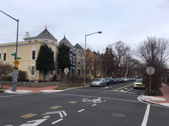
Warm weather has your humble blogger eager to try Washington's
numerous bike lanes and trails
There's a first time for everything, and today was my first time to try a bike share service. Bike sharing is quite the thing these days in cities, and Washington has a number of options about which you, my faithful readers, are doubtless dying to learn. Capital Bikeshare has bikes for rent at numerous locations around the capital city. Dockless options include Jump BikesLimebike, Mobike and Ofo. Jane used Mobike awhile ago. I enrolled with Ofo. I downloaded the app in February, but it's taken til this week before I had the combination of weather and time I needed to try it out.

I opened the app, which revealed a map. The nearest yellow symbol denoting a bike was a short walk from my house, in front of an alley dwelling on Library Court SE.

However, it wasn't going anywhere without a major operation. It was secured with three straps and a rope. (Dockless bikes are locked electronically; this was clearly extra-curricular.)

I sent an e-mail to report the situation, then looked for the next-nearest bike. This was farther away, such that I took a city bus to get to it. (My dedication to you readers knows few bounds, as I'm sure you realize.) I found it easily, on the sidewalk in front of a bakery.
That's my helmet. I came prepared.
I took a picture of the QR code on the rear fender to unlock the bike, which started the meter. As I wheeled it away I instantly realized the chain was off its guard. This happens with bikes, but when I went to fix the situation I found the chain was actually padlocked.

So this bike wasn't going anywhere, either, at least not with me. For the record, the kickstand was also janky.

I sadly left the bike where I'd found it. Ofo reports my ride lasted 4 minutes, and went a distance of 75 feet. I burned 1 calorie, and saved 0 ounces of carbon. It cost me $1.

By now, though, more bikes were appearing on my map. One was a mere three blocks away. Getting there took me past the birthplace of John Philip Sousa!

Also, Christ Church Washington Parish, built in 1806 and still holding two services every Sunday morning.

A block west of the church was this bike.

I approached it cautiously, as one would after being "twice bitten." But it seemed ideal to my purposes, and I was ready to commit. However, at this point, my app froze. I couldn't get it to do anything. I don't know if it objected to my trying to get my second bike in less than an hour, or to my being a narc, or whether it was just exhausted from my tireless research done on your behalf (behalves?), oh devoted readers. (Apparently, this happens, too. The Ofo website suggests uninstalling and reinstalling the app.)

The bike and I stared at each other longingly, as though we were the Louisiana woman and Mississippi man made famous by Conway Twitty and Loretta Lynn. (At least I assume the bike was longing; perhaps I was projecting.) Then I walked home. At least I got my 10,000 steps for the day.

The snows of March have melted... let's ride!

King Street that Complete Street

 [W]e... want to celebrate the exemplary Complete Streets initiatives that are transforming policy into practice and creating places for people.... [T]his report highlights a handful of the communities, people, and places that are embracing implementation and equity in their Complete Streets efforts.--Emiko Atherton, Director, National Complete Streets Coalition ("Best Complete Streets Policies" 5)
Alexandria, Virginia, has been included among "The Best Complete Streets Policies of 2017" by the National Complete Streets Coalition, a division of Smart Growth America. The award is for the re-do of King Street, the city's main artery.

The most famous section of King Street is through Alexandria's Old Town District, running about a mile from the Metro station to the Potomac River waterfront. This section won a Great Streets Award from the American Planning Association in 2011. The APA noted:
[A] 1992 plan led to redevelopment from low-scale warehouses, an auto dealership, and surface parking to offices, hotels, restaurants, and infill commercial development.... With its attractive mix of dining, retail, and other attractions for residents and visitors alike, King Street continues as an economic center and gathering place for the City of Alexandria--a role it has served since George Washington drew early plats for the street in 1749.
free trolley (funny-looking bus) service runs all day between
the Metro station and the waterfront
Alexandria's website lists several waves of follow-up to the 1992 plan: a 2005 King Street Retail Strategy for Old Town from Metro Station to the waterfront, a 2008 King Street Outdoor Dining Overlay Zone adopted to encourage restaurants to offer outdoor dining options, and retail wayfinding signs for King Street which are part of citywide program. The result is a tourist-friendly zone of small specialty shops and restaurants, built close to the street on small blocks.

The Potomac River

shipbuilder, Waterfront Park

Old Town shops tend towards the touristy

The Atheneum (1852), formerly a bank,
now headquarters of the Northern Virginia Fine Arts Association

Stabler-Leadbeater Apothecary (1805); where Robert E. Lee got his meds

Market Square and City Hall

Gadsby's Tavern (1770), still a working restaurant

wayfinding signs

The CVS was one of the few shops I saw catering to everyday life.
There are no grocery stores on King Street, but several nearby

Christ Church (1773), where George Washington worshipped

more functionality: the library branch

restaurants have much outdoor seating, just for days like this
Yes, there's coffee! Misha's seemed to be a favorite among the locals


The George Washington Masonic National Memorial dominates the
landscape by the Metro station...
...though the smaller War Memorial is closer
The recent recognition from the National Complete Streets Coalition was for Alexandria's efforts to improve King Street above the Metro station, where it is a thoroughfare with single-family homes and non-commercial destinations (T.C. Williams High School, the large multi-use Chinquapin Park including a recreation center, several churches and a historic cemetery). Its average daily traffic count in 2017 was about 13,000. The group notes Alexandria added crosswalks, buffered bike lanes and updated bus stops, as well as reducing auto lane width and reducing the speed limit to 25. After a year there were no crashes on the re-done road which had long averaged seven a year, auto speeds were down 18 percent, and there was zero-to-minor increase in congestion at intersections. NCSC also praised their community feedback and impact evaluation processes ("Best Complete Streets Policies" 34-36). Since King Street is also State Route 7, the State of Virginia must have been involved as well.

T.C. Williams High School, which is enormous
Chinaquin Park has multiple features, including a woodsy trail
First Baptist Church of Alexandria, largest of several churches on the route
(and they're planning an expansion)
Ivy Hill Cemetery dates from 1856
Side court with big houses

A big house. Neighborhood residents clearly had the political power
to block these changes, and they didn't. Props to them for that.
Crosswalk treatment
Another crosswalk treatment
Buffered bike lane south of the high school

The bike lane shifts as it approaches the intersection with Janney's Lane

Below Janney's Lane the bike lane becomes the dreaded sharrow
Intersection closed to cars. I don't know when this was done.

Speed indicator on the northbound side just above the Metro station.
Note the grim-looking privacy fence which runs about 1/4 mile along the sidewalk
I'm a fairly confident bicycle rider, but would I ride to Old Town from the high school or the Baptist Church? Maybe, possibly--there are still some holes in the bike infrastructure. I did walk it, on a Thursday mid-day, and found it pleasant and unfrightening. Alexandria is to be congratulated on the progress it has made.


SOURCES


City of Alexandria, "King Street," https://www.alexandriava.gov/kingstreet/

National Complete Streets Coalition, "The Best Complete Streets Policies of 2017," https://smartgrowthamerica.org/resources/best-complete-streets-initiatives-2017/

"TransAction Plan Includes and Defines Bike and Pedestrian Projects for Northern Virginia," WashCycle, 13 December 2017

Saturday, April 21, 2018

Bike lanes for Irving Street?


A public meeting is expected early this summer on a proposed re-do of Irving Street in northern Washington, D.C. Irving currently has three rootin'-tootin' lanes each way, making it the exemplar of an auto conduit that had been grafted onto the urban framework in the day when everyone was going to drive everywhere. Its average daily traffic count is 18300-20400, meaning that most of the day its high capacity and superhighway design create an invitation to drive fast.

Part of the plan for Irving Street is to create two-way protected bike lanes. Washington has a lot of bike infrastructure, compared to other places I've spent time, but it has a lot of active cyclists as well. Moreover, there is a hole in the bike map right about here; there is no way to get by bicyle from the northwest side to the northeast side (or vice versa) north of R Street. So viable bike lanes would create an important link in the system, connecting the Brookland neighborhood to Columbia Heights and Petworth, and creating bike access to the Washington Hospital Center, Catholic University and other area employers.

It also promises to improve pedestrian access/safety by slowing the cars. When I walked the proposed route on a windy Thursday mid-afternoon, I saw only one cyclist (on the sidewalk) but quite a few pedestrians going both directions. Every single time I stopped at a curb a driver waved me across, a still-amazing-to-me feature of Washington that I'm going to have to unlearn once I leave. But that's not something you can necessarily count on, even here, particularly when they're merging off or onto the cloverleaf at North Capitol.

Kenyon Street at the west end of the route, just east of Warder.
Kenyon's already under construction, so it's hard to tell how it would be impacted.

Wangari Gardens, on the south side of Kenyon,
approaching the merge into Irving

Wangari Gardens again.
How many of those 18300-20400 speeding cars know this is here?

Kenyon and Irving. Wonder what happened here?

Crosswalk from the southside of Kenyon to the south side of Irving. 
(The bike lanes would likely be on the north side of the streets.)

Approaching Washington Hospital Center.
At 1st Street NW, one scenario has the lanes shifting from the north side of Irving
to the center median, which will be a tricky interface indeed

Approaching the cloverleaf intersection with North Capitol Street

Part two of the cloverleaf. In the distance is the majestic basilica at Catholic U.
We are now on the northeast side.

Approaching Catholic University, Irving intersects with Michigan.
The lanes would continue on Michigan for one block.

Intersection of Michigan and 4th Streets from the steps of the basilica.
4th Street NE will have protected bike lanes soon, from Michigan south to Lincoln.
In this 1970 poster (displayed at the Anacostia museum) protesting a proposed blitz of highway development in central Washington, Irving is shown as a normal street. with Michigan as the thoroughfare:

So I'm guessing the widening of Irving happened to compensate for the central freeway not being built?
The Green Line was constructed instead

Protesting the Central Freeway proposal in Brookland
(taken at the Anacostia Museum)

Protesting the Central Freeway proposal in Brookland
(taken at the Anacostia Museum)
Washington is not unique in having bulldozed neighborhoods in order to facilitate auto traffic. The Irving Street re-do, improving bicycle and pedestrian access between northwest and northeast Washington, will help to enhance the neighborhoods that remain.

SEE ALSO: Crosstown Multimodal Study

Crosstown Multimodal Transportation Study area map
Source: dccrosstownstudy.com

Iowa and the vision thing

Brenna Bird, Iowa Attorney General Iowa's legislative session ended this week, and there's not much to say about its efforts that I ...