Thursday, May 28, 2015

Envision CR IV: Neighborhood stores

Is this corner in need of a store?
One of the critical factors in whether people walk at all is whether there are places to walk to. This hit home to me last summer while I was investigating how people used Redmond Park on Cedar Rapids's southeast side. I was interested in whether the busy three-lane one-way 3rd Avenue served as a barrier to park use. It didn't, but what really impressed me is how many people I saw walking from the surrounding neighborhood through the park, across 3rd Avenue, and then across 1st Avenue to Hy-Vee Food Store. Hy-Vee itself isn't constructed in a pedestrian-friendly way--whether coming from Mound View or Wellington Heights, any pedestrian has to make their way across several lanes of parking lot--but it is impelling enough to get people to walk, across the parking lot and all those busy streets.

1st Avenue Hy-Vee
Neighborhood stores--small-scale operations located in residential areas--have pretty much disappeared from American towns and cities, but before World War II they were plentiful in any populous community. Historian Mark Stoffer-Hunter refers to Scolaro's on 1st Av and 29th St NE as "one of the many small grocery stores that served the people living nearby" (Henry and Hunter 2005: 54). When poet Paul Engle (1908-1991) was in high school, he worked at a drug store a couple blocks from his home:
I spent seven hours a day, seven days a week, for seven dollars a week, in that little place crammed with drugs, lotions, tonics, tobacco, candy, ice cream, ointments, soft drinks, writing papers, newspapers, magazines, and the row of pumps with their many flavors called a soda fountain.... Now, of course, the drugstore culture has deteriorated--real drugs instead of a soda fountain! (Engle 1996: 36; similar reminiscences from Kingsport, Tennessee, in Stallard 2008)
The Paul Engle Center for Community Arts is in the former pharmacy building
The last two of the neighborhood groceries depicted by Henry and Hunter, the Food Center Neighborhood Grocery Store and Merklin's Cash Grocery, closed in the 1970s. By the time we moved to Cedar Rapids in 1989, two independent groceries operated nearby, both in strip malls; both closed within two years. Even the 1st Av Hy-Vee nearly closed in 2000, saved only by a $1 million grant from the city.

Today our city's groceries and pharmacies are mostly large, with some ethnic groceries in strip malls, and two recently-arrived gourmet groceries (Fresh Market and New Pioneer Co-op). Two Super Wal-Marts and two Super Targets also have grocery and pharmacy sections. None is particularly easy to walk to from any residential neighborhood, though the 1st Av and Oakland Road Hy-Vees aren't bad if you don't mind hustling around parking cars. And then there are the convenience stores, mostly attached to gasoline stations, the closest thing we have to the small, neighborhood stores of yore, but hardly the same breed of cat.

Jim's Foods, in a strip mall on 6th St SW, has survived by shifting to a convenience store model
The size of grocery stores, pharmacies, hardware stores, &c. has expanded along with everything else in America. A visit to the supermarket provides a breadth of selection that would stagger my grandparents, at prices (thanks to economies of scale, among other things) that enable me to eat (and shave, block the sun, and do simple home repairs) in the style of a king. So why not just declare victory and move on to the next topic?

Because neighborhood stores have benefits, benefits that are widely touted, such that they appear on some level to be merit goods. Their presence reduces auto use and increases walking, increases the number of community-building interactions both in the store and on the way, and adds to the attraction of the area (Duany et al. 2000: 187-188; Jacobs 1961: 36-37; Mitchell 2009). Locally-owned stores, as opposed to mini-Targets or Wal-Marts, keep the profits in the community. From these direct benefits spring secondary benefits too numerous to list in a reasonable post. In particular, it's hard to imagine recent walkable-scale, residential development in downtown Cedar Rapids and the nearby areas of Kingston and New Bohemia succeeding for long without stores where life's necessities can be purchased.

Benefits or not, any reappearance of neighborhood stores faces serious hurdles. As urban areas sprawled in the latter half of the 20th century, people moved far away from shopping and work. Hunter and Henry note that the Fifth Avenue Market and Grocery once had over 100 houses nearby, almost all of which have been torn down (p. 55). Residences may now be too widely dispersed to support a small neighborhood store. Functional zoning means commercial and residential uses are kept apart: neighborhood over here, stores over there. Even where zoning ordinances permit mixed-uses, residents are often hostile to the idea of inviting corner stores into their neighborhoods. Duany, Plater-Zyberk and Speck explain:
[W]hat the neighbors are picturing instead is a Quick Mart: an aluminum and glass flat-topped building bathed in fluorescent light, surrounded by asphalt, and topped by a glowing plastic sign. It's not that these people don't need convenient access to orange juice and cat food like everyone else; they just know that the presence of a Quick Mart nearby will make their environment uglier and their property values lower.... The building type of this corner store is essentially the same as the town houses next to it: two stories high, three windows wide, built of brick, and situated directly against the sidewalk, which its entrance faces. One could imagine it may even have been a town house once, so well does it blend in among its neighbors. [2000: 26-27]
Finally, there is the business plan question: Can neighborhood stores make a profit when most people can drive to a supermarket with wider selection and (I'm guessing) lower prices? I did some furtive price comparison today on a "market basket" of breakfast items, with these results:


Supermarket (large store)
Supermarket (small semi-walkable store)
Posh market
C-store
½ gal skim milk
1.58
1.69
1.99
3.39
Orange juice (12 oz conc or 48 oz bottle)
1.98
1.79
5.70
8.00
Sandwich bread (24 oz)
1.69
1.69
5.25
n.a.
Name brand wheat flakes cereal (10.9 oz)
2.50
2.50
5.50
n.a.
One dozen large eggs
2.09
2.68
2.99
n.a.
Oranges (1 lb)
1.59
1.99
1.50
n.a.
TOTAL
11.43
12.34
22.93
n.a.

Maybe I picked the wrong c-store? Anyway, it shows that the farther you get from the suburban supermarket model the more prices go up, and for anyone with a car that can be a deciding factor. So does the same logic apply to a corner store?


Duany and colleagues suggest that developers not only include corner stores, but provide the space rent-free because the store makes an attractive amenity yet "should not be expected to turn a profit until the neighborhood matures" (2000: 187). But that applies to new development, and doesn't analogize well to existing neighborhoods.
Highway 100 extension, from thegazette.com; can we sprawl our way to neighborhood stores?
What does the city's master plan adopted in January, Envision CR, say about corner stores? Specifically, nothing--the phrase is never used. The "Grow CR" section describes a "mixed land use pattern," but the specific example of "housing above commercial and office establishments" (p. 55) means apartments downtown, not corner stores in neighborhoods. On the future land use map (p. 67), much of the new development anticipated around the Highway 100 extension is expected to be "urban-medium intensity;" some areas, mostly around downtown, are "urban-high intensity;" and most of the existing city is "urban-low intensity." That means that established neighborhoods can expect little change, but at the edge of town newer developments--if they occur--could see "neighborhood retail or mixed use" included on "any street provided a smooth transition in intensity of uses is maintained" (p. 69). That opaque language may be all we should expect, and maybe it even intends all we could hope for, but the specific reference to "mixed-use" at the new, improved Westdale (p. 82)--it will include a bit of senior housing--is hardly encouraging. I'd like to see more affirmation of the concept, and more expressed flexibility in how all areas of the city develop over time, but I understand that creating too much uncertainty could create panic.

SOURCES

Andres Duany, Elizabeth Plater-Zyberk and Jeff Speck, Suburban Nation: The Rise of Sprawl and the Decline of the American Dream (North Point, 10th anniversary ed, 2010)

Paul Engle, A Lucky American Childhood (University of Iowa Press, 1996)

George T. Henry and Mark W. Hunter, Cedar Rapids: Downtown and Beyond (Arcadia, 2005)

Jane Jacobs, The Death and Life of Great American Cities (Random House, 1961)

Stacy Mitchell, "Neighborhood Stores: An Overlooked Strategy for Fighting Global Warming," Institute for Local Self-Reliance, 19 August 2009, http://www.ilsr.org/neighborhood-stores-overlooked-strategy-fighting-global-warming/

"Neighborhood Store," BusinessDictionary.com, http://www.businessdictionary.com/definition/neighborhood-store.html ... their definition, oriented to specialty stores, is too restrictive for our purposes

Kenny Stallard, "Neighborhood Stores," Memories from the Past, 2008[?], http://freepages.military.rootsweb.ancestry.com/~whitetwp/neighborhood_stores.htm

EARLIER POSTS
Envisioning CR I: A 24-hour downtown, 1 March 2015
Envisioning CR II: Including the poor, 17 March 2015
Envisioning CR III: Improve public transportation, 6 April 2015

NEXT: Regional governance.

Sunday, May 24, 2015

Cycling update

Spreading the word and passing out swag at the pit stop, Bike to Work Week 2015

Protected bike lanes are coming to Iowa! When Cedar Rapids's 3rd Avenue is converted from one-way to two-way, part of an ongoing re-orientation of downtown streets, it will include bike lanes along the curb, with parallel auto parking between the bike lane and the traffic lane. This graphic was shared at the trail pit stop at 4th St and 1st Av during Bike-to-Work Week:

The array will run about a mile, from 2nd St SE to 6th St SW. The goal is to encourage more people to ride bicycles by creating a greater feeling of safety. There's even a narrow buffer zone between the parking and the bike lane; I doubt it's wide enough to prevent dooring, but it might give the rider a bit of warning. Anyhow the unusual placement of parking spaces might remind auto travelers to look before they open their doors. At least it provides some room if the driver's aim is off when putting the car in the parking space.

The left turn boxes (lower right of the graphic) would help keep bikes out of heavy traffic when turning. I'm guessing they might not be all that necessary in light traffic, and might not appeal to our more aggressive bicyclists anyhow.
 
I approve of the incremental approach to bicycling infrastructure in Cedar Rapids. It makes sense that before you stripe the entire city, or dump a vat of green paint, or buffer all the bike lanes, that you would do it in a small space first to see how it works. If only we'd done this with urban renewal, or interstate highways, or multipurpose sports stadiums... Which metrics to use when assessing the buffered bike lanes might be a tricky issue. Do we count bike riders on 3rd Av (and do we have a baseline)? Car-bike interactions? Public approval?

I first heard of protected bike lanes happening in Bogota, Colombia, as featured in the documentary "Urbanized." A spin around the Internet finds them installed or planned in ChicagoColumbus, Honolulu, Little Rock...

Little Rock: Bike lanes protected by parking

...Minneapolis, Pittsburgh, Seattle and a host of other cities... though not yet in Newark, Delaware, or, until now, in Iowa. The buzz about protected bike lanes is mostly happy, as you'd expect from results tilted towards biking advocacy--there do not seem to be any blogs yet on "Why Can't Everyone Just Drive Like Normal People Do?" (perhaps because Iowa Gov. Terry Branstad is too busy). Reporter Angie Schmitt noting protected bike lanes have been associated with less auto speeding, fewer crashes, more cycling, increased retail sales along the routes, and eventually widespread public support, with--counterintuitively--no increase in auto travel times or congestion despite the reduction in traffic lanes. Protected bike lanes may take some getting used to, but I think they'll be worth it.

VIDEO: "Protected Bike Lanes 101" by People for Bikes

SOURCES
"Bike Lanes," National Association of City Transportation Officials, http://nacto.org/cities-for-cycling/design-guide/bike-lanes/

"Protected Bike Lanes--Update 04.01.15," People for Bikes, https://docs.google.com/spreadsheets/d/11H0gArHxo6kMop1I18yMcq7ArbNrwaGBLmIXgqI1Gjk/edit#gid=3

Angie Schmitt, "The Rise of the North American Protected Bike Lane," Momentum, 31 July 2013, http://momentummag.com/the-rise-of-the-north-american-protected-bike-lane/

Jim Williams, "City Introduces New Curb-Protected Bike Lanes," CBS2, 19 May 2015, http://chicago.cbslocal.com/2015/05/19/city-introduces-new-curb-protected-bike-lanes/... contains a few discouraging words

Thursday, May 14, 2015

A win for today; a strategy for the future?


The way we lay out our communities can really be evaluated in terms of how well do they do moving us on that continuum from strangers towards friends--REV ERIC O JACOBSEN

The Methodist preacher will offend you not/He's raising money for a parking lot--GARRISON KEILLOR

Save CR Heritage, our local historic preservation organization, held a press conference yesterday morning at Westminster Presbyterian Church to announce the results of complicated negotiations to save a historic house.

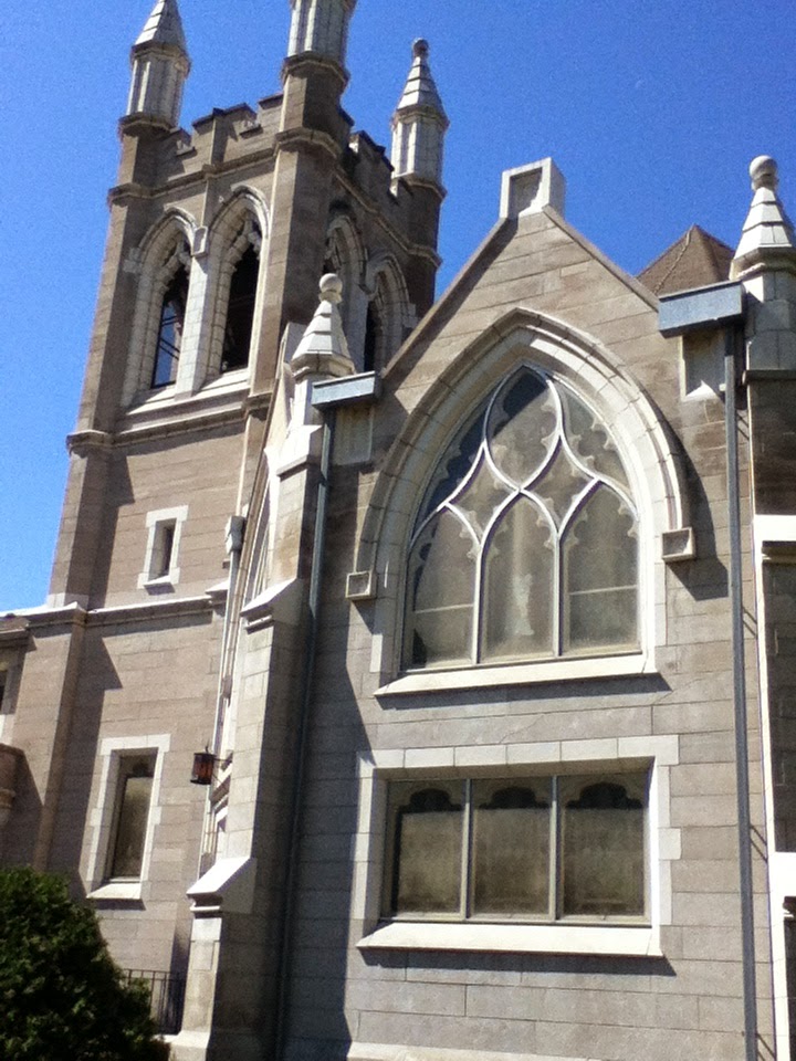
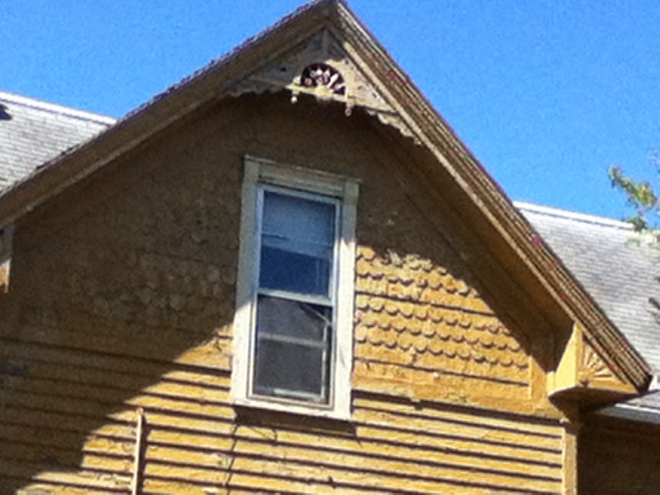
The "Frankie House," built in 1896, sits agedly in the way of Westminster's parking lot expansion.


Westminster Church itself was built in 1904, with several additions since.


The deal, which my sources credit to persistent shuttle diplomacy by Beth De Boom and Emily Meyer of Save CR Heritage, starts with Save CR Heritage moving the house--with labor donated by D.W. Zinser Co.--to a lot on 5th Ave SE currently used as a community garden by the Wellington Heights Neighborhood Association. The garden will move to nearby property currently owned by Affordable Housing Network, Inc. Save CR Heritage will renovate and sell the house, and Wellington Heights will have some new neighbors. Pastor Emory Gillespie of Westminster, Wellington Heights Neighborhood Association president Justin Wasson, AHNI executive director Renie Neuberger and Cedar Rapids historian Mark Stoffer-Hunter also described how the arrangement furthered their goals.

My friend John Shaw, who's on the Historic Preservation Commission in Iowa City, describes preservation efforts as one win for every twenty you lose. By that standard, saving the Frankie House is not only a win but well worth celebrating. On top of that, it raises hopes that a similar deal can be worked out to save a nearby neighborhood landmark that reportedly stands in the way of another church's parking expansion.
Habitat for Humanity volunteers work on historic Wellington Heights home (from SaveCRHeritage Facebook page)
 
So let's pop a cork and drink to saving CR's heritage!

This happy outcome should buy some time for neighborhood residents, institutions and preservationists to think about a long-term strategy for urban neighborhoods. The one sour note yesterday was sounded by Stoffer-Hunter, a brilliant and assiduous historian. He didn't dwell on it, and I don't know if he even intended to be sour, but while discussing the story of the Frankie house's construction (for a local physician whose family included a 4-year-old boy named Frankie) and the original details that survived...


...Stoffer-Hunter noted there is "a lot of great history on this block," including the childhood home of Mamie Doud Eisenhower. Moving the Frankie House preserves this historic home but leaves another "tooth" missing on this historic block.


The mania for flattening neighborhoods into parking lots arises when institutional needs for expansion push into the neighborhoods where they settled years ago. In recent years, Coe College, Mercy Hospital, Physicians Clinic of Iowa, St. Luke's Hospital and St. Paul's United Methodist Church have also expanded their footprint. Now, St. Paul's and Westminster churches are at one end of a two-mile-long parking crater that stretches from Coe to the edge of the New Bohemia district. All this surface parking leaves neighborhoods with missing teeth, struggling neighbors with less connection to economic opportunity, and an overall loss of walkability and vibrancy in the area.

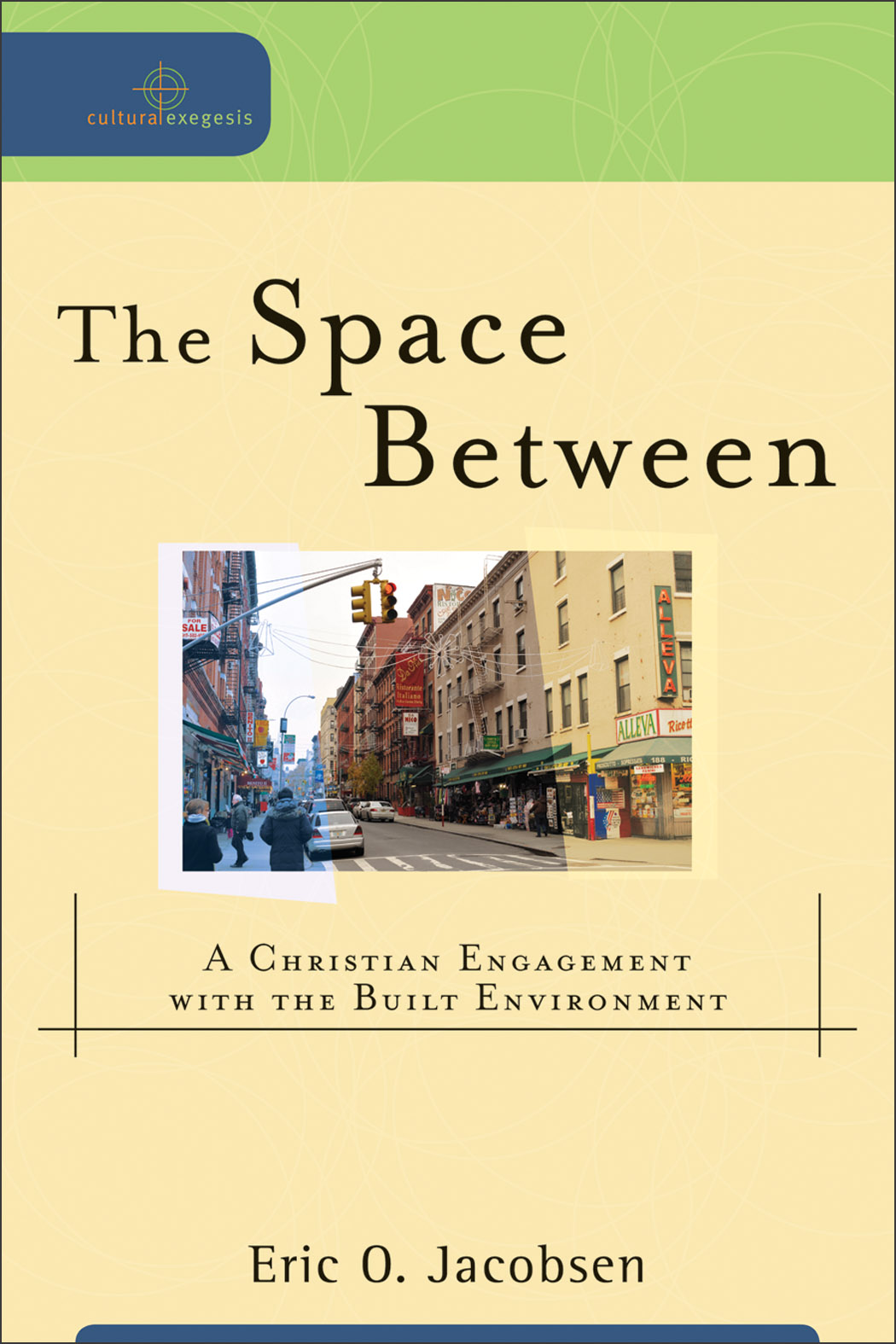
Rev. Eric O. Jacobsen, senior pastor at First Presbyterian Church in Tacoma, Washington, notes that Christians tend not to think about physical environment, thinking that access to cars, high-tech communications, and social groups make location irrelevant. His recent book, The Space Between (cited below), is both an introduction to urbanism aimed at Christians, and a call for Christians to become active in improving the "space between" where they live and where they attend church. When the built environment treats humans with dignity, it improves their lives, their relationships, and their opportunities. Individual civic virtue, and social capital, are framed by Jacobsen as examples of "common grace," blessings from God that may be bestowed upon both Christians and non-Christians.

Faith communities (churches, in the Christian vernacular) have a stake in whether or not the neighborhoods in which they are located are built on a human-scale or for automobiles. Human-scale neighborhoods treat people with dignity and encourage participation in common life. Jacobsen classifies churches as embedded (built in ways that facilitate direct connections with the community that surrounds them) or insular (oriented toward people driving cars). It's not strictly time-based, but embedded churches are typical of traditional neighborhood development, while insular churches reflect the auto-driven development common in America since World War II. Note, particularly if you're not religious and are losing interest, that while Jacobsen focuses on Christian churches, a similar logic could apply to colleges and universities, hospitals, grocery stores, coffeehouses, bars, and even office buildings.

Rev. Gillespie noted yesterday that Westminster made a specific commitment 15 years ago to remain in Wellington Heights. Their outreach includes a Kids Closet and the Loaves and Fishes Food Pantry, both of which surely provide lifelines to individuals on the edge, as well as participation in the Family Promise homeless ministry. But Jacobsen's work suggests institutions can go beyond seeing their neighborhoods only as opportunities for charitable work, but as parishes--places in which they live and which they can help build.

How can institutions engage with each other, and with city government, to make their neighborhoods better places? Jacobsen and the urbanists argue for greater attention to the built environment, particularly the oft-underrated contribution it makes to individual and social life. For a long time, Wellington Heights has been treated as a neighborhood to drive through, rather than as a place where people live--witness the speedways that 2nd and particularly 3rd Avenues have become--though the 2013 passage of a neighborhood plan indicates the city is taking a more positive approach. Can institutions lend their weight to returning Wellington Heights to its historic status as a walkable neighborhood connected to economic opportunity?

The first thing anyone will notice with a parish approach is that expanding surface parking areas doesn't help places. As institutions try to grow, are there alternative approaches to parking issues that are compatible with successful places (particularly for churches who are near their parking capacity about one hour a week at most)? What about encouraging members to park in unused commercial lots or on the street? What about working with the city to institute public transit service on Sundays?

READ MORE AT:

Cindy Hadish, "Save CR Heritage Announces Collaborative Effort to Save Historic Home," Save CR Heritage, 13 May 2015, http://savecrheritage.org/save-cr-heritage-announces-collaborative-effort-to-save-historic-home/

Eric O. Jacobsen, The Space Between: A Christian Engagement with the Built Environment (Baker Academic, 2012)


Rick Smith, "Save CR Heritage Will Save One Itself," Cedar Rapids Gazette, 14 May 2015, 8A

Thursday, May 7, 2015

Garfield School celebrates 100 years

Garfield School
Two Cedar Rapids schools celebrated 100 years of existence today. Arthur School, 2630 B Av NE, and Garfield School, 1201 Maplewood Dr NE, both were built in 1914 and began classes in the 1915-16 school year. I celebrated with Garfield, where my boys went to school, and where I've been able to continue my relationship as a classroom volunteer. Both schools continue to anchor residential neighborhoods, although their attendance areas--particularly Arthur's--are quite large.

Principal Joy Long did the morning announcements outside,
as the entire student body assembled
Flag raising by the 5th grade Girl Scout troop,
followed by the Pledge of Allegiance
Nancy Raue (left) attended Garfield and has taught there since 1989.
That's her VW. Based on the sign, she must have been Honorary Principal for the day.
Even President Garfield was celebrating!

Main festivities were scheduled after school
...including a hot dog supper...

...and a brief, well-attended program in the gym.
Principal Joy Long kicks off the program
A number of students present and past returned for the event, including one fellow who'd attended Garfield in 1936. At the evening program, former principal Rick Netolicky [right in picture above] emceed, paying tribute to his valuable secretary Chris Gochenour, as well as inviting past and present teachers and staff to stand and be recognized. Mayor Ron Corbett [center left] proclaimed today to be Garfield School Day in Cedar Rapids; of course, he also proclaimed it to be 2017, so take that how you will. Historian Mark Stoffer-Hunter [far left] recalled the origins of the school, pointing out the unique Egyptian columns at the main entryway. Current principal Joy Long dedicated a reading cart in memory of former secretary Kris Cessna, who died in 2013.

Hardwood features of the classrooms (here, room 106) give them an old-fashioned vibe
Buildings like Garfield, the stories they have to tell, and the good service they still do, are testimony to worthiness of historic structures in cities like Cedar Rapids.

SEE ALSO:
Cedar Rapids Community School District, "Arthur and Garfield Celebrate Centennial Birthdays," http://www.cr.k12.ia.us/arthur-and-garfield-celebrate-centennial-birthdays/
Cindy Hadish, "Garfield and Arthur Schools to Celebrate 100th Anniversaries," Save CR Heritage, http://savecrheritage.org/garfield-and-arthur-schools-to-celebrate-100th-anniversaries/

Garfield's playground was re-constructed in, I think, 2003

Friday, April 24, 2015

Post No. 150: NO! NO! Not a SIXPENCE!!

Charles Cotesworth Pinckney (1746-1825) knew a bad deal when he met one
Those readers concerned about the supply of America's chutzpah resources may take comfort. John Frew, who is leading the redevelopment of Cedar Rapids's dying Westdale Mall, has determined that the $10.5 million city taxpayers have contributed to this project is not going to be enough, not by a long shot. If this commercial property and its sprawling parking area, completely inaccessible by anything but motor vehicles, is going to live again, it's going to take another $11.5 million. A very white elephant--by comparison, the current phase of downtown redevelopment, which has some actual civic significance, will cost about $3 million--just got whiter.

The city hasn't immediately responded to this ask, instead forming a Special Westdale Review Committee of the City Council to review and make recommendation. City Manager Jeff Pomeranz made a most guarded public statement: The amount and terms and conditions of assistance are fluid, depending on negotiations.

Given that it hasn't yet been agreed to, it is premature to become outraged at the wanton expenditure of public money on a project that has no civic benefit. So I'll have to settle for being irked that Mr. Frew apparently felt very comfortable asking for the extra dough. What does this say about the relationship of developers to city government? About the relative weight in policy decisions of the public interest versus personal connections? And if anyone thinks that, in the end, they won't get whatever they ask for, I would welcome a reassuring communication.

Thankfully, the ask is "sufficiently significant" (in the words of reporter Rick Smith) that Pomeranz recommended City Council consideration, and that the Gazette reported it on the front page. How much goes on that doesn't trip these triggers?

If Westdale Mall can once again be the site of successful businesses, that would be great. But it should be up to businesses to make those decisions, without government subsidies. Even in its heyday, Westdale was probably not supplying the revenue-per-acre that you would find in a well-designed downtown. And, surrounded by "stroads" as it is, it will never be integrated into a walkable community. (See this TED Talk by architect Ellen Dunham Jones featuring some ways mall projects have achieved real connection.) Westdale could crumble into rubble without impacting the City of Cedar Rapids.

Reading this news, I immediately flashed on a quotation attributed to Charles Cotesworth Pinckney, a South Carolinian who participated in the U.S. Constitutional Convention of 1787, and was later appointed ambassador to France by President George Washington. While there, he and two other American representatives were approached by men purporting to speak for the French government who demanded substantial bribes in order to settle the issues that existed between the two countries. (The incident became known as the "XYZ Affair.") Pinckney's response, later prettied up into "Millions for defense, not a cent for tribute," actually was something like "NO! NO! Not a sixpence!"

In this budget-conscious era, we need to demand greater caution and accountability in public spending. Transparency should be easiest at the close-by local level. We need to learn to say "NO! NO! Not a sixpence!" to dubious investments of our money, whether they be malls on the edge of town, baseball palaces in cornfields, or water parks that require their own interstate exits. At the very least we ought to rid ourselves of the illusions that these projects are somehow going to pay for themselves in the long run, or that these sorts of deals are the only way to get the town we "deserve."

All this budgetary stuff comes as I reflect on two years of this blog. Reading and writing, listening and watching have taught me a lot, and I continue to feel that within all of us are the seeds of a community that nurtures, strengthens and values each of its members. New urbanism, to which I attach, is one movement that is trying to build a brighter-yet-workable future. The Westdale stuff reminds me that while we work for this vision we also need to cry out against public actions that work against community-building. "First do no harm," said Hippocrates.

Second, the city should not be paying for projects that waste public money and harm the city's capacity. NO! NO! Not a sixpence!

SOURCE: Rick Smith, "Westdale Mall Developer Asks for More Upfront Money to keep Construction Going," Cedar Rapids Gazette, 13 April 2015, http://thegazette.com/subject/news/developer-asks-for-more-upfront-money-at-westdale-mall-to-keep-construction-going-20150413

EARLIER POST ON WESTDALE: "A Big Ho-Hum," 12 May 2013

Monday, April 6, 2015

Envision CR III: Improve public transportation

The #3 heads downtown on 2nd Av SE
One of the most encouraging sections of Envision CR, the city's recently approved master plan, is undertaking a new approach to the city's bus system. The section on transportation begins by promoting the idea of multi-modal transportation, which includes:
  • Public infrastructure that connects neighborhoods and destinations;
  • Elimination of barriers that discourage or obstruct pedestrians, cyclists and transit users;
  • Project designs that provide safe and pleasant passage from the public to the private realm.
The plan then lists four criteria for evaluating pedestrian and bicycle systems: (1) directness, (2) integrity [connect to places and provide continuity], (3) safety and (4) comfort. Surely these apply to bus transit, too!

There are two initiatives listed that are specifically bus-related: one general promise (#37, "Continue to evaluate transit ridership and serviceability to identify opportunities for improvement") and one specific and praiseworthy idea (#38, which "explores the possibility of creating a BRT-like (Bus Rapid Transit) crossroads that connects users from Lindale Mall to Westdale, and from Hiawatha to Kirkwood Community College").

The second, scheduled for implementation in 4-5 years, would be the second major initiative in city transit since I moved to Cedar Rapids 26 years ago. The first, about 1997, took a motley collection of moderately usable neighborhood routes and converted them into wandering loops each of which takes exactly an hour to run. This has improved coordination of routes at a significant cost in utility, particularly for those with any available alternative to the bus. If the city truly wants to expand service beyond the transit-dependent, conceiving routes that are direct and connect to places is an excellent place to start. And we could run those routes at least until midnight, instead of putting the system to bed at 6.

There has been a lot written about transit. Two excellent blogs, Human Transit (Jarrett Walker of Portland, Oregon) and The Transport Politic (Yonah Freemark of Chicago), are devoted entirely to the issue, and Strong Towns has given it a lot of attention. Transit policy talk is mainly aimed at larger cities than Cedar Rapids, but here are just a few insights on which we could build:

Freemark: [B]us services in cities around the country are often simply too slow and too unreliable for many people to choose them over automobile alternatives. Rail, particularly in the form of frequent and relatively fast light and heavy rail, may be more effective in attracting riders, but so might, the article hypothesizes, BRT services, which provide many of the service improvements offered by rail ("Recent Trends in Bus and Rail Ridership," 3 March 2014). I don't know that Cedar Rapids is populous or dense enough to support light rail, but we could start by looking for places and ways BRT could compete with automobiles for speed.

Walker: In the transit world, for example, we know that ridership arises from a relationship between urban form (including density and walkability) and the quantity of service provided ("Basics: Conceptual Triangles," 23 January 2011). He describes a triangle, the points of which are Development (density and walkability), Service (frequency and span), and quantity of Ridership. Any of these can be treated as the outcome of the other two. This suggests that areas of dense activity (downtown, Kirkwood, the malls at one time but maybe not anymore) are potential objects of transit. It also suggests that the more Cedar Rapids sprawls--far more resources are being put into exurban development than downtown or the core neighborhoods--the harder it is going to be for anyone to get around in anything other than a private vehicle. Public transit in a sprawled city is fundamentally absurd.

Strong Towns: A Strong Town builds wealth by connecting financially productive places with transit. A Strong Town uses a transit approach scaled to the places being connected ("Strong Towns Knowledge Base: Transportation"). It could be that the next two steps--after our BRT-like routes are online--in improving bus transit in Cedar Rapids are (1) building financially productive places (right now the only one I can think of is downtown and maybe New Bohemia), and (2) cutting existing service that is unproductive. It may be that an efficient, usable bus transit system for Cedar Rapids is smaller than the one we have now.

Where could/should transit be going? Here, for starters, are the traffic counts of more than 10,000 cars per day in Cedar Rapids in 2013 (omitting I-380, US-30, and interstate access):

1st Av E-W (Twixt Town Rd NE to 18th St W)

6th St SW (US-30 to 16th Av)
7th Av Marion (w of downtown, including Marion Blvd)
8th Av Marion (w of downtown)
10th St SE (1st Av to 8th Av)

16th Av SW (West Post Rd to Rockford Rd)
19th St SE (1st Av to 2nd Av)
Blairs Ferry Rd NE (Milburn Rd to Marion Blvd)
Boyson Rd NE (Creekside Dr to Alburnett Rd)
C Av NE (74th St to Old Marion Rd)
Collins Rd NE (Edgewood Rd to 1st Av)
Edgewood Rd NE-SE (Blairs Ferry Rd to US-30)

Kirkwood Blvd SW (US 30 to 76th Av)
Northland Av NE (Collins Rd to Blairs Ferry Rd)

Wiley Blvd SE (16th Av to Williams Blvd)
Williams Blvd SW (18th W out)

Auto traffic patterns measure demand for transportation. Does that help us see where there are "financially productive places," in ways that can help plan transit that is more efficient and effective, and even popular?

SEE ALSO:
Cedar Rapids transit official page: http://www.cedar-rapids.org/transit/
"Connect CR" section of Envision CR, http://www.cedar-rapids.org/government/departments/community-development/city_planning/Documents/connect.pdf
Transitmix is a really fun and thought-provoking public transportation simulator

EARLIER POSTS
Envisioning CR I: A 24-hour downtown, 1 March 2015
Envisioning CR II: Including the poor, 17 March 2015

Next: Neighborhood stores.

Tuesday, March 24, 2015

Jeff Speck in Cedar Rapids


(3/24/2015) "Walkable places are thriving places," says Jeff Speck (pictured above), architect, author and city planner. Speck, now based in Boston, was in Cedar Rapids to "re-communicate" the importance of safe street design, in hopes of spreading the word to a wider audience, and to sustain the energy behind important changes already begun by the city. He spoke to about 60 people at the new City Services Center on 15th Street SW.

The title of his talk was "The Safe Walk;" among the elements that make for a walkable city, he said safety--both real and perceived--is the factor most directly impacted by government action, specifically design of the street. He focused on downtown Cedar Rapids, saying it was the part of the city that has the greatest potential to be "truly walkable."
 Important design elements include:
  1. small blocks, allowing for two-lane streets, and resulting in far fewer traffic deaths.
  2. two-lane streets, which can easily handle 10,000 cars per day, including 1000 at peak hour. More lanes merely encourage cars to drive faster, and drivers to jockey lanes, which are less safe. Long left-turn lanes cost "a flank of parking."
  3. two-way streets, countering a trend in many cities beginning begun in the late 1960s to move to one-way streets. One way streets do move traffic more quickly, but at costs to safety and businesses.
  4. skinny streets, with lane widths 10 feet or fewer. 12 foot lanes common in newer neighborhoods are the same width as highway lanes, with predictable results: wider lanes encourage faster driving resulting in more deaths.
  5. bicycle lanes, to encourage biking. Results from Portland and New York City found more biking with fewer injuries and less speeding by drivers. Sharrows and "Share the road" signs do not have this effect.
  6. parallel parking, which creates a "barrier of steel" protecting the curb from moving vehicles, thus encouraging walking as well as al fresco dining.
  7. doing away with push-buttons at traffic signals, which are pretty well useless. He recommends going with a standard signal (pedestrians go when the cars go) or LPI (pedestrians get a slight lead). He prefers four-way stops, which in a Philadelphia study showed 24 percent fewer crashes and 68 percent fewer pedestrian injuries.
Speck's ideas have influenced a gradual redesign of downtown streets. He praised our city's "good bones," i.e. blocks of 300 square feet. But many of our downtown streets have for years been four-lane one-ways, and none carries more than 7000 cars per day. The redesign calls for slow conversion to two-way streets, with more angle parking and bike lanes (not in the same blocks, though!).

What about the rest of the city? Cedar Rapids resident Martin Smith asked about the strata of neighborhoods that lack sidewalks (in areas built between the time when they were customary and the current time when they are legally required). Speck said he'd noticed such a street near "the high school"--I think it could have been any one of the three high schools, but let's say Cottage Grove Avenue for starters--and said he'd start by asking if the street were wide enough to stripe a walking area or a "shared path." "Obviously," he conceded, the long-term goal is real sidewalks.

Speck was introduced by Dave Elgin (pictured at right, from linkedin.com), who is retiring at the end of the month after many years as Cedar Rapids's city engineer. In his remarks Elgin touted the city's newly-adopted comprehensive plan, Envision CR, and noted that public feedback continues to support and demand a vibrant, energetic city. He said Speck has been consulting with the Department of Public Works since 2012.
 
SEE ALSO: Ben Kaplan, "An Interview with Jeff Speck," We Create Here, 25 March 2014, http://www.wecreatehere.net/2015/03/25/an-interview-with-jeff-speck/

NOTE: Jeff Speck's presentation is archived here. Thanks to Brandon G. Whyte at Corridor MPO for the link.


Jeff Speck's books include Suburban Nation (co-author), The Smart Growth Manual (co-author) and Walkable City
 

EARLIER POSTS

"What is a Complete Street?" 13 August 2014, http://brucefnesmith.blogspot.com/2014/08/what-is-complete-street.html
"Biking in the 21st Century," 28 June 2013, http://brucefnesmith.blogspot.com/2013/06/biking-in-21st-century.html

Cherokee Trail update

  You can get there from here! The Cherokee Trail, which eventually will run all across the west side of Cedar Rapids, is complete between ...