 |
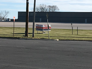
| 2317: One of many smokeshops on the road, used to be a bookstore |
I've gone a bit off-script for this year's celebration of #BlackFridayParking. Strong Towns has promoted this event since the mid-10s as a way of highlighting the high costs to cities of zoning regulations that mandate large commercial parking lots (Abramson 2023). Past Black Fridays have taken me to the parking lots of big-box stores on our city's outer edge, and to the vast parking lots all too close to our city center.
Amidst all the giddiness and photography, I've come to the conclusion that, in Cedar Rapids anyway, the problem is not the zoning code. Our giant Wal-Marts and Targets have parking lots even bigger than the code requires, because land is cheap here, customers expect it, and the city is designed in such a way that 90+ of people are going to drive to shop anyway.
In 2017 I walked 16th Avenue SW, a mid-century commercial corridor that is now a model for discarded sprawl.
 |
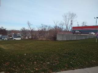
| Still empty in '23: former K-Mart parking lot, 16th Av SW, November 2017 |
The problem on 16th is not that even large Black Friday crowds couldn't fill the gigantic parking lots, but that there are no crowds at all. (That year I was accompanied by "the other Dr. Nesmith." I don't know whether the excitement was too much for her, but she hasn't been tempted by #BlackFridayParking since.)
This year I followed a similar impulse to Mt. Vernon Road SE. This historic corridor is getting some love from the city in the form on an action plan. Alas, its internal contradictions mean some of its goals are going to have to give way, probably to faster vehicle traffic.
The Mount Vernon Road action plan covers 10th to 44th Streets.
 |
| 4035: At the east end of the plan area, acres of parking at the Mt. Vernon Road Hy-Vee |
The executive summary describes the challenge on page 19:
The Mt. Vernon Road corridor includes a wide variety of land uses including a neighborhood hardware store, a large grocery store, several gas/convenience stores, banks and credit unions, professional offices, restaurants, bars, and various specialty, variety, drug, auto parts, auto repair, and discount goods stores. The corridor also includes schools, churches, a residential care center, a fire station, and a cemetery.
 |
| 2405: Used to be a pharmacy |
However, the dominate [sic] land use is single family residential with just a few multi-family residential properties sprinkled throughout the corridor. There are several quick-serve and fast food restaurants but few sit-down style restaurants. There are vacant properties along the corridor and some occupied commercial sites that are dated and/or in need of renovation and maintenance. There are also several retail uses that are typically not considered neighborhood friendly including tobacco shops and liquor stores.
Because that's the kind of commerce wide fast streets get!
 |
| 2663: Used to be a Greek restaurant |
 |
| 2700: Used to be an Italian restaurant |
Unsurprisingly, public input sessions on the action plan revealed desires for small retail shops, redeveloping vacant lots, fewer "less neighborhood friendly uses," more separation between residential and commercial areas, turn lanes, and slower truck traffic. Bike lanes were nixed, as bicycling on this road is unsafe and slows car traffic (p. 19).
 |
| Word clouds generated by Mt. Vernon Road corridor public meetings |
 |
| 902 28th St: Cute shop for a walkable area |
 |
| 3605: Another vacant property, whose potential changes on a walkable street |
The public's desires are reflected in the plan's goals (p 9): (1) promote new retail development and redevelopment along the corridor; (2) encourage neighborhood scale and neighborhood friendly uses; (3) improve traffic circulation and safety; (4) increase walkability and safety for pedestrians and cyclists. I expect the immediate pressure to improve traffic circulation to render the rest of this admirable list unfeasible. I hope I can explain why.
 |
| 1841: Neighborhood retail lost to road widening |
 |
| 1901: Neighborhood retail lost to road widening |
Neighborhood retail (goals 1 and 2) relies on walkability (goal #4), but that would require Mt. Vernon Road to become smaller and slower (goal #3b but not #3a). The stickler, as the plan's authors admit (p. 11), is that Mount Vernon Road has been developed into an arterial, the collector road for the entire southeast side. The authors claim it has too much traffic already--23000 according to the plan text, 18000 according to the state's average daily traffic counts--for its four lanes, and there are too many driveways for comfort as well.
 |
| 3303: Even small parking lots are between the (franchise) shops and the sidewalk |
Since it is pretty much the only through street in that part of town, there's no reasonable alternative for truck traffic.
 |
| 3025: More franchises by parking lots |
So the road will be reconfigured to restrict left turns across traffic at 15th and 19th Streets; it will end in a roundabout at 10th Street; parking lot access will where possible be redirected to side streets; and cyclists will be directed to alternative routes on parallel streets.
 |
| Approaching downtown, new left-turn lane onto 15th Street, creating more distance between core neighborhoods on either side |
Cars and trucks will move more swiftly, past locations that could have supported neighborhood friendly uses. (See Herriges 2019 on how arterials work, and don't work.)
 |
| 1420: Gargantuan c-store, nominally in Wellington Heights |
This is the point where I should be telling you what the city should be doing to fix this. I confess I'm at a loss. What are we trying to build here? It's not a downtown, where we go for density, mix the uses, slow the cars, and ignore the parking-obsessed. It's not the suburbs, either, nor is it quite a highway. It's become an awkward mix of all three, so that anything you do to fix an immediate issue with Mt. Vernon Road--narrow it, widen it, add pedestrian infrastructure--is going to make something else worse.
 |
| 3401: Vernon Village used to have a small grocery and a French restaurant, which then became a bakery/cafe. Now it might be a ghost kitchen? |
(I would like to see bus service along the entirety of Mt. Vernon Road, just shooting straight from downtown to maybe Bertram Road and back. Currently, the circuitous Route 2 travels Mt. Vernon Road eastbound from 19th to 42nd, but not westbound. I don't know that it will fix anything detailed above, help the emergence of cute shops, cut down on vehicle speeds, or make walking safer, but it's curious that this has never been done.)
 |
| 2714: Another auto parts store, next to another vacant building |
So, this year my #BlackFridayParking thoughts have wandered far from the subject of parking. But as we see here, excess parking is more than some unproductive government regulation. It is a product of the problematic way we build towns, and how we get around, just as it makes those problems worse. The result is stroads like this one. The parking lots are just the most obvious symptom, or maybe #2 behind the uninspiring commerce.
 |
| 2000: Used to be an arts center, before that an elementary school |
The public comments that informed the Mt. Vernon Road Action plan are not wrong, just naive. It's natural for us to want more of the things we enjoy, with fewer consequences. Why can't we have smoother traffic flow and plenteous parking, at cute shops, all at a neighborhood scale? Because, beloved readers, in this vale of tears, cars compete with everything else for space, and the easier we make it for cars to move the less likely they are to stop, to shop or for any other reason.
 | ||
2711: Big pharmacy with bigger parking lot
|
The more room we make for cars in the form of parking lots, the less room there is for anything at a human/neighborhood scale. Anyone who's paid attention as Mt. Vernon Road has gotten wider and faster knows this. That's not politics, it's physics.
 |
| 26th St: One of several cute dead-end streets off Mt. Vernon Road Access becomes more difficult as the road gets faster |
 |
| 18th St: From here to downtown, access is limited by a barrier |
Strong Towns video, "Are Parking Lots Ruining Your City" (15:40):
SEE ALSO: "Black Friday Parking 2022," 25 November 2022
Mark Stoffer Hunter, "History Happenings: Changes Coming to Mount Vernon Road and 19th Street SE," Cedar Rapids Gazette, 24 November 2018
Ben Kaplan, "Mount Vernon Road is Dangerous by Design," Corridor Urbanism, 11 June 2021
Rahul Rejeev, "Children, Left Behind by Suburbia, Need Better Community Design," Public Square: A CNU Journal, 13 November 2023
 |
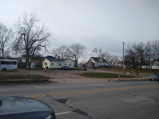
| 3404: One of many vacant stores on Mt. Vernon Road |


No comments:
Post a Comment