Tuesday, August 15, 2023

Cycling to Marion


Uptown is a coffee shop by day, a bar by night,
and never disappoints

In a couple years, cycling from Cedar Rapids to Marion will be as easy as floating on the breeze, because construction of the CeMar Trail will have been finished, creating a loop between the two towns. Even waiting one year will get you completion of the missing link on the Grant Wood Trail between the Nature Trail and Council Street.

But I was ready last week, and noting the summer fast ebbing away, I rode the Cedar Valley Nature Trail as far north as 51st Street, then straight east--mostly on the Grant Wood Trail--to Marion. Not to be morbid, but the impending start of the school year and the ensuing change of seasons meant the diem needed to be carped. The trip took me about 35 or 40 minutes each way. Actual mileage may vary. On a humid day, I was grateful for the air conditioning at both ends of the trip.

Uptown Marion is emerging as one of the metro's most attractive commercial districts, and while I live and work near two others, variety has been proven to be the spice of life. So off I went. My reward for all that exertion was Uptown Snug, a key Uptown bar for years, which recently opened a coffee shop in the front. Uptown Coffee checks all the coffee boxes, whether you enjoy your brew in the calmly lit bar area, or outdoors on the Art Alley.

Uptown shares frontage on the Art Alley with
a number of other fine establishments

I'd done outside all the way up, so sat in the bar, next to a table where some high school English teachers were talking pedagogy and the upcoming school year. Just overhearing their thoughtful conversation measurably improved my frame of mind. Bring it on, I now say. A good third place with good coffee will have that effect on a person.

Marion also offers the opportunity for celeb-spotting. Is that Brooke Prouty ducking into Shorts for lunch? Could be! Let's give her some space, though, and not trouble her for an autograph.

The trail route to Marion does have some pressure points. Some are temporary:

  • Cedar Lake. As construction around the lake proceeds, the trail is closed. A sign seems to direct cyclists up Shaver Road, which is do-able, though it takes you out of your way and requires reconnecting to the trail via J Avenue (narrow and curvy). The better route is crossing the tracks to a temporary bike lane on 10th Street, which is how I got back, but I found the interface between 10th, H, and Shaver confusing, and I may have unwittingly executed a dangerous move to get across the streets and back to the trail.
  • 51st Street. The gap between the two trails is bridged on this wide east-west street, but first you have to get across Center Point Road (traffic count 13500). There is a crossing button going east across the street, but not on the opposite side for those going west. I didn't have any difficulty either way, but this is a junction that gets a lot of complaints from regular trail riders,. Getting the eventual connection right when the Grant Wood Trail is completed remains under discussion. 
  • Council Street. For now, until the final link is added, the Grant Wood Trail starts/ends at this frenetic stroad (traffic count 11100). On the way up I crossed Council at 51st Street, and got to the trail by cutting across the movie theater parking lot (not a problem in the morning, not sure I'd try it in the evening). On the way back I crept along the sidewalks on Council Street while hoping for a break in traffic, which eventually happened.
These issues will all be fixed, or at least addressed, within a few months when the Grant Wood Trail is connected to the Cedar Valley Nature Trail. There remain several busy street crossings on the route that use rider-activated crossing lights to warn drivers: 1st Avenue on the CVNT, and Rockwell and Lindale Drives on the Grant Wood Trail. 
Different part of town (Boyson Road NE),
but an example of rider-activated lights

Even with crossing lights, I prefer to hang back and wait for traffic to clear, rather than pushing the buttons. That morning I got amazingly lucky and caught two breaks in traffic on 1st Avenue (which crossing has definitely been improved a lot anyhow). The only street I had difficulty crossing was Rockwell, which sent cars in unending driblets of two and three, so that I resolved to use the button on the way back. And I did use the button, but one car ran through anyway, reminding me why I prefer to hang back and wait for a break.

That leaves two pressure points on the route riders should expect:

  • 42nd Street. This section of the Cedar Valley Nature Trail runs along I-380, and crosses the exit ramp as well as 42nd. This has been engineered about as well as could be imagined, with the sight lines for both exiting vehicles and cyclists very good. I still prefer to walk my bike through this intersection. Maybe some day I-380 will be rerouted around the city instead of through it.
  • C Avenue and Blairs Ferry Road NE. These are two of the city's busiest streets, and their intersection has all the characteristics of danger. The Grant Wood Trail, which runs along the north edge of the Collins Aerospace campus, tunnels underneath Blairs Ferry (yay) but then takes you on a wide sidewalk directly to the intersection with C Avenue (boo). With many turning cars and one grocery-toting pedestrian present, I dismounted and walked across C. From there, trail users go up a wide sidewalk by a gas station on C to an access road that runs between Amoco and Walgreen's (not great either). 
After that, though, it's duck soup all the way into Marion. The trail goes just south of the 6th/7th Avenue roundabout at 7th Street, then follows a wide sidewalk on the south side of 6th Avenue (eventually separating at 31st Street). Along the way I rode for the first time across the delightful rebuilt railroad bridge over Marion Boulevard. When I arrived in Uptown I found coffee, air conditioning, and doughnuts. Summer was made for exactly this!

Or do you somehow prefer the beach??

Tuesday, August 8, 2023

Crossing Cedar Rapids' busiest intersections: 1st Avenue

cars on a wide and busy street
Looking up 1st Avenue from 6th Street W:
The wide street bisects mixed use areas with no safe place to cross

1st Avenue is unique among the busiest streets in Cedar Rapids because it is not a stroad at the edge of town, but rather plunges straight through the city center. It is the spinal cord of our street network, abutting some of the city's oldest neighborhoods and its best pedestrian infrastructure. It has been the main drag since before there were cars. It was U.S. 151 until 1989, when it became Business Route 151 (Hancock). It draws a lot of vehicle traffic because there really is no alternative street for getting across town; no parallel street to 1st goes for more than a few blocks. Its high vehicle load, frequently turning from side streets or parking lots, and wide design (usually five lanes), create dangerous challenges for pedestrians. I've had a couple of close calls myself. 

[At about 18th Street West, the thoroughfare switches onto Williams Boulevard, while 1st Avenue winds through residential neighborhoods for another five miles. We, however, will be looking at the biggest oldest stretch of 1st Avenue through the core.]

Urbanist planner Sean Hayford Oleary asked on streets.mn: Why does walking feel so intuitive when we're in a city built before cars, yet as soon as we return home, walking feels like an unpleasant chore that immediately drives us into a car? He responds to his own question: We don't design the pedestrian experience for dignity. It is hard to find dignity along much of 1st Avenue, and quite a few stretches don't even feel safe to walk along or cross. The city has added some helpful crossing treatments in spots, but others remain problematic. It is not a street I will frequent when my mobility declines.

The title for Oleary's piece for streets.mn begins "If We Want a Shift to Walking..." Do we, though? A wide street carrying most of the vehicle traffic through the center of town is by definition going to be a challenge to cross. And it is quite the challenge, pretty much all along the route, except maybe on Sunday mornings. Past decisions have left us with a series of dilemmas along 1st: how to accommodate both people who use this as a thoroughfare for vehicles, and people in adjacent neighborhoods who need (loaded word, I realize) to access schools, grocery stores, and such across this dangerous street.  

Starting on the east side, where I have lived all these years, and with which I am most familiar...

trail underpass

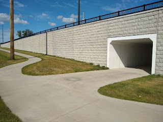
30th Street trail underpass. This was part of a major reconstruction of 1st Avenue a couple years ago. The CeMar Trail will eventually connect Cedar Rapids and Marion, but can also serve as a way for nearby pedestrians to access Walgreen's drug store on the south side or Arthur (soon to be Trailside) Elementary School on the north side, for example. 

27th Street. There used to be an overpass here, originating I think to accommodate students walking to Arthur School. Did it get used, or was it too cumbersome to tempt people away from scooting directly across the street?

21st Street/Cottage Grove Avenue. A wide sidewalk was recently added to connect Washington High School, Franklin Middle School, and the CeMar Trail. There's another traffic light at 19th Street, on the other side of Franklin. But it's a long way from 21st to 19th, more than the implied 0.2 mile, and 20th Street is what Franklin is actually on. Crossing there could definitely be improved.

19th Street SE approaching 1st Avenue
Crosswalk across slip lane merging 19th Street SE
onto 1st Avenue (Google Earth screen capture from 2021)

19th Street. We're getting into some serious core now. 19th Street SE forms the eastern boundary of Wellington Heights, while 20th Street NE forms the eastern boundary of Mound View. Crossing is made more dangerous by the slip lane moving traffic from 19th Street SE onto 1st Avenue. On a brighter note, 1900 1st Avenue is slated to be a Dunkin' Donuts, which is less pedestrian unfriendly than the gas station/convenience store proposed last year.

grocery store parking lot across busy street
Park Court at 1st Avenue, July 2014

16th Street/Park Court. 16th Street NE has the traffic light where it ends in a t-intersection with 1st Avenue, next to the Hy-Vee grocery store which was slated to close in 2000 before $1 million from the city kept it open to serve the surrounding neighborhoods. The city missed the chance back then to move the storefront to at least one of the streets, and to rectify the pedestrian crossing at 1st which frustrates drivers and pedestrians alike. (On the southeast side, both 16th Street SE and the much-traversed Park Court end at 1st Avenue without crossings; pedestrians are directed to the traffic light half a block away, which not all of them follow. In 2020 I proposed rerouting 16th Street to give people coming from the southeast side a straight shot to the grocery store.)
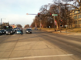

crossing-eye view of six lane street
College Drive/13th Street E, April 2014
crossing-eye view of five-lane street
Removing one-left turn lane in 2021 improved traffic flow
and pedestrian safety (Google Earth screen capture)

13th Street/College Drive. Both crossings by Coe College have been considerably improved, though they remain risky. Before 2021 there were two left turn lanes on 1st, dating I think from the time before I-380 when traffic was routed onto certain two- or three-lane one-way streets (including the street that is now College Drive). It's still a long way across 1st Avenue from campus to the apartments or the cafe on the corner (opening soon!), but there are fewer rows of cars to cross, and since left-turning cars can now turn at any time during the green light instead of having to wait for the green arrow, the drivers are likely to be less desperate.

cars approaching intersection
Coe Road/12th Street E, September 2013

12th Street/Coe Road. At 12th, where Coe sits across from Casey's convenience store and Via Sofia's restaurant,...

intersection with crossing buttons
Coe Road/12th Street E, July 2023

...the right turning radius has been tightened, and a walk button and striped crosswalk have been added.

10th Street. This is the main street of the MedQuarter, with medical facilities on both sides of 1st Avenue, and has a bus stop and some fine-looking crosswalks. A car came at me in one of those crosswalks a few weeks ago, and I had to scramble out of the way. A police officer saw it all from his car. I made eye contact. The officer made eye contact. Later I found out it's not technically against the law to nearly-hit someone.

8th Street and 7th Street. Twin one-way streets that are the main ways to access and egress I-380 from the east side of downtown. Wherever you cross this intersection, be extra careful, especially when crossing right-turn lanes.

crosswalk with motion sensors
4th street trail crossing, May 2014

4th Street. This is where the Cedar River Trail crosses 1st Avenue near downtown, right by the hotel/entertainment complex the city bought ten years ago. I have never been comfortable crossing here, but recent work has definitely improved it. 

4th street crossing now
4th street trail crossing, May 2023

There are more and better flashing lights, now at driver's eye level, and there's a median in the middle of the street so you're not taking on all four lanes at once.

building construction project
1st and 1st project under construction

1st Street W. The Kingston area on the southwest side has seen explosive development since the 2008 flood and subsequent. Land that had been cleared for a casino is being developed as a hotel, brewery, pickleball court. Other attractions, unfortunately including the inevitable casino proposal, may follow. This intersection is likely to be quite the hotspot, particularly if we anticipate people visiting more than one place. A key crossing light has been added between 1st and 3rd Streets W for when pedestrians can access this area again.

multifaceted intersection
L Street NW spills off the highway and onto 1st Avenue
(not pictured is a really nice sidewalk on that side of 1st,
leading to that intersection)

3rd Street and L Street. Twin one-way streets that are the main ways to access and egress I-380 from the west side of downtown. Wherever you cross this intersection, be extra careful, especially when crossing right-turn lanes.

church across large intersection
a wee median but no crosswalks by St. Patrick's Church, 5th Street W

5th Street. Past the interstate 1st Avenue is back to cleaving older neighborhoods, on this side the Taylor Area in the southwest quadrant and Time-Check in the northwest. As on the east side, crossing from one neighborhood to the other is serious business I would not encourage either an 8-year-old or an 80-year-old to undertake. 1st Avenue got some serious working over between the river and 6th, but there will still be six lanes in front of this parish church--seven on the other side of 5th--without much help to cross them.

buildings across intersection
crosswalk at 6th Street W

6th Street. For many years 6th Street has been a main thoroughfare through the near southwest side--it goes all the way to Coralville!--but a short side street on the northwest side. Most excellently, the city has just punched it through to connect with Ellis Boulevard NW, which should lead to some good things. It will be interesting to observe the evolution of this intersection. There are a bunch of small restaurants and bars around here, as well as some ethnic groceries, that could benefit with more pedestrian traffic, but that will only happen if it's safe to walk.

10th Street. This is the first traffic light above 6th Street. The intersection features a Family Dollar, a Kwik Shop convenience store, and a bar called Gilligan's. The corner lot next to Gilligan's has been vacant since shortly after the flood. Above 10th, 1st Avenue is mostly residential.

13th Street. 13th Street NW was disconnected from 1st Avenue a long time ago and made a dead end. This is where 1st and 3rd Avenues come together, which may be complexity enough for one intersection. Traffic from downtown sweeps off 1st onto 3rd, which is a crossing hazard.

15th Street. The old Lincoln Highway briefly used 1st Avenue from 13th to 15th Streets, then went through the northwest side on Johnson Avenue. This intersection provides access across 1st to the Johnson Avenue Hy-Vee, Roosevelt Middle School, Cleveland Elementary School, Veterans and Kingston Stadiums, and Cleveland Park.

1st Avenue presents the same mobility dilemmas as our exurban stroads, but more intensely. There are more people living near 1st Avenue, and there should be. There are all manner of places for non-drivers of all ages to go, close enough to access by foot, bicyle, or wheelchair. The core of any city is its most critically important area, and where walkability is not only desirable but historically baked into the design. I keep seeing this quote attributed to former Milwaukee mayor John Norquist: A city is where people come to work, raise families, spend their money, walk in the evening. It's not a traffic corridor. 

Yet there's a reason 1st Avenue carries 20,000-25,000 cars a day, and they aren't just going to disappear.

SEE ALSO: 

"What is a 'Stroad?'" 3 April 2014

"Figuring Out a Dangerous Intersection," 24 September 2013

"Walking Down to the Edge of Town," 2 August 2013

Monday, August 7, 2023

The age/race gap in Iowa

 
Governor Kim Reynolds and cornfield
Iowa politicians sell nostalgia and homogeneity to their large white majority
(campaign ad screen capture... see video at foxnews.com)
(you could spend a semester unpacking this ad)

The times they are a-changin'--BOB DYLAN

America is getting older, but there's more to it than that, according to William H. Frey, senior fellow at the Brookings Institution (Frey 2023). The oldest Americans are predominantly white, while the younger generations are far more racially diverse. According to data from the 2020 U.S. Census, whites are a minority among those under age 18, and less than 55 percent of those aged 18-44 (see Frey's Table D).

Americans 65-plus were 27.5 percentage points whiter in 2020 than those under 18. This age/race gap increased from 22.7 points in the 2000 census. Frey argues this has amplified generational cultural divides, as seen in responses to the Supreme Court decision on affirmative action and state policies limiting diversity in public school curricula. (See also Frey 2018.) 

William H. Frey
William H. Frey (from brookings.edu)

The same age/race pattern appears in each state and metropolitan area: the older the group, the more white, and the younger the group, the more nonwhite. States differ in how strong that effect is, but it's present everywhere (see maps 1a and 1b in Frey 2023). 

Compared to the states that surround us, Iowa is somewhat older and whiter, and has a smaller age/race gap than of our neighbors except Missouri. We're pretty similar to most of them on the metrics used in Frey's article, with the exception of Illinois, which is more diverse among all age groups, and has had a steep decline in the proportion of under-18s of any race.

The largest gap is in Arizona, where the oldest group is 77.9 percent white and the youngest is 37.2 percent white, a gap of 40.7 percentage points; that may account for that state's notoriously riven racial politics over the years featuring the likes of Evan Mecham, Jan Brewer, and Sheriff Joe Arapaio. Nevada, New Mexico, Delaware, Rhode Island, Florida, and Oklahoma are the next six. The age/race gap may account for the scorched-earth toxicity of, say, Florida governor Ron DeSantis; but it's noteworthy that not all states with a large age/race gap experience the same political expressions.

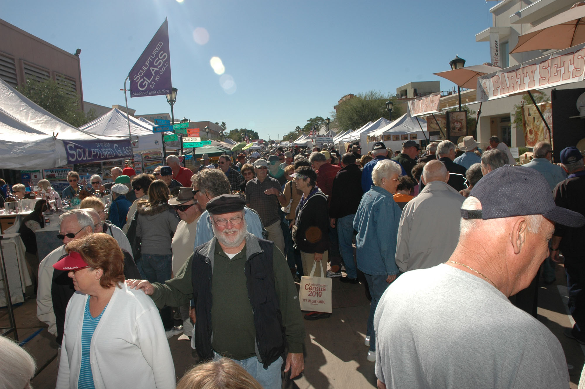
crowd at a fair in Arizona
Older white Arizonans have had to get used to diversity
(Source: cronkitenews.asu.edu)

The age/race gap is smallest among states that remain predominantly white. These states also tend to have small and declining populations, because with a few exceptions (Idaho, North Dakota, Utah) the white birth rate is low everywhere. Seven of the ten smallest gaps--West Virginia (#1), Vermont, Maine, New Hampshire, Kentucky, Wyoming and Montana--are in states who are also among the ten whitest states in America. On the other hand, the District of Columbia (#2) and Hawaii (#5) are so diverse even their oldest age groups are not that white. 

Iowa is the sixth whitest state according to the 2020 Census, with 82.7 percent of Iowans identifying as white (mixed-race not included). Iowa's age/race gap is 21.1 points, 35th highest (a.k.a. 16th lowest). Iowa is 15th in percentage for both over 65 and under 18. That's an explanation, but only a partial one, for why we Iowans have been far more receptive to the white nationalist politics championed by Donald Trump than are Maine, New Hampshire, and Vermont. Perhaps, like North and South Dakota (and Wyoming?), our age/race gap may be small by national standards, but it's gotten large enough to alarm the traditional establishment.

Iowa's approach to public education--which old-timers will tell you was once a source of state pride--is not unique but is an outlier even for states with aging, predominantly white populations. As the current school year approaches, the state is shifting substantial funds to private education through vouchers, as well as sending ominous but vague directives to remove books deemed offensive from classrooms and libraries. This is after the state's per-pupil education funding change from 2016 to 2021 trailed all neighboring states except Nebraska, not to mention all five states that have whiter populations.

At the county level, the four Iowa counties that favored Deirdre De Jear in the 2022 gubernatorial election tend to be younger and more racially diverse than the state as a whole, particularly Johnson (home to the University of Iowa) and Polk (home to the state capital). These are the counties Governor Kim Reynolds excluded from "the real Iowa," and while her statement was hateful, on some level she was also correct. Johnson, Polk, and a very few other counties are neither as white nor as old as the whole state.


(Note that I wasn't able to replicate Frey's data at the county level with 2020 census data, so I used data from the 2021 American Community Survey. To keep the age categories consistent with the original presentation, I split those aged 35-44 in half. Even American Community Survey data were not available for all counties.)

The larger age/race gaps in Johnson and Polk are also more typical of the country as a whole than the State of Iowa. Another relatively diverse Iowa county had an even higher age/race gap: Woodbury (Sioux City), 80% white, had 34.6 points (93.1-58.5), which is getting towards Arizona-level difference. Black Hawk (Waterloo), 82.9% white, had 23.9 points (90.5-66.6). 

Demography is certainly not political destiny--not every nonwhite person is down with The Squad, cares deeply about immigration policy, or even guaranteed to vote Democratic. But it does point to changes in the way of doing things (see Arizona and Georgia in recent years) and the difficulty of maintaining a sense of common life in the face of that change. 

Whether to change is not a choice. It happens everywhere, even in Iowa, though certainly not as much or as fast as in the United States as a whole. Every community does have a choice whether and how to accommodate that change. That choice is not between white prosperity and inclusive prosperity--it's between successfully managing diversification and irrelevance. Not only our souls, but our future is at stake.

Music for urbanists: Lift Every Voice and Sing

Anne Harris Carter presents Mike and Toni Loyal with the 2025 Who is My Neighbor Award, as Pastor Jonathan Heifner looks on (Sunday 1/19 at ...