 |
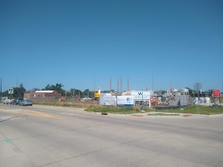
| View of NewBo Lofts site from Geonetric building |
Big plans for what's dubbed the NewBo Expansion remain the most intriguing feature of the Czech Village/New Bo Area Action Plan adopted by the City of Cedar Rapids in December 2019. The city website explains the plan follows similar planning initiatives already completed... These plans take the concepts identified from the City's comprehensive plan, EnvisionCR, and develop action steps and goals tailored to a specific geographic region. Most of the development was anticipated within three years (pp. 81-87), but of course the coronavirus pandemic intervened and then came the derecho.
The NewBo Expansion covers the area between 16th Avenue SE and the Cedar River down to the Cargill plant (about 10th Street SE). Prior to the June 2008 flood the area contained a lot of derelict industrial properties as well as some small houses; nearly all of that has been demolished. The area action plan contains a variety of initiatives, spread across numerous pages, which I have compiled on this crudely-drawn map:
The disclaimer that comes with this plan, of course, is that dreams appear in plans that don't ever get built (see Westdale, the Highway 100 extension, or any schematic ever). But as I look out at the Extension through my summer office window it seems worth a tour of what's there now and what might be there some day.
Most of the anticipated development is described as "mixed-use" (p. 72):
The NewBo Expansion area will develop around a core of mixed-use development sites. Retail and restaurant uses could occupy the ground levels of an office building and multi-family housing enclosing the Sinclair Plaza [on 3rd Street, where the pavement currently ends].... Stretching out from this high-activity public plaza, building uses would transition to strictly residential...
 |
| the future Sinclair Plaza (see p. 55) |
 |
| Sinclair Plaza, looking up 3rd St towards 16th Ave |
3rd Street will be extended to an intersection with 9th Street. (Despite their names, these streets aren't parallel now, and will be less so in the future.) Alongside 3rd Street will be a "promenade" (p. 64) from Sinclair Plaza past 9th Street to a new branch of the Cedar River Trail. "Tuck-under" townhomes would line the north side of 3rd Street, providing the “eyes and ears” for the desired promenade and bicycle amenities" (p. 72).
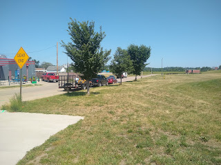
3rd Street looking towards the river
4th Street, which will also be extended to 9th Street, will mostly have parking areas along it, though "Two small-scale “missing middle”
housing buildings could sit on the west side of the
4th Street and 16th Avenue intersection" (p. 72).
 |
| non-Geonetric side of 16th: 300 block |
 |
| Geonetric side of 16th: 300 block |
 |
| NewBo Lofts development, which I guess is on the "east" side of 4th St |
On the opposite side of 4th Street would be the 4th Street Trail Extension (p. 64), which completes a loop on the Cedar River Trail, connecting at 7th Avenue and across the river over the new Smokestack Bridge. It crosses 12th Avenue at 5th Street next to Geonetric, crosses 16th Avenue next to the roundabout, then angles over to where 4th and 9th Streets will meet.
 |
| future intersection of 4th and 9th Streets |
From there it swings south to cross the river and meet the current trail.
 |
| the bridge that was, and will be again, from the NewBo side |
 |
| ...and from across the river, on the existing trail |
River access and overlook (p. 57) will augment a paved trail spur that already runs along the river from the end of 10th Street...
...to 2nd Street and 16th Avenue.
That intersection currently hosts Kickstand but has three undeveloped corner, including the former location of Hach Bottling House:
Mixed-use infill development is planned for all three corners.
The east end of the NewBo Extension will is projected for small single-family housing in the area of 9th Street and 16th Avenue (p. 77).
A old stone building on 9th Street is planned for retrofit: Some possible uses include an incubator complex,
makerspace, arts cooperative, and destination restaurant or
brewery.... Lying along the proposed 4th Street Trail, the renovated
building program could extend out into a series of exterior
spaces that would provide amenities for trail users specifically
and also the public at-large (p. 74).
There are definite advantages to infill development, as opposed to further extending the edge of the city. One question is how much should the city pay to make this all happen? Working with the system we have, as opposed to the system we wish we had, I'm OK with the incentives for developing the Banjo Block downtown and First-and-First across the river in Kingston, because those are path breaking developments that can bend the curve in the core of the city. But where do you stop paying for development, and leave market forces to work their magic? For example, I'm less convinced on something like the Loftus Lumber block in New Bohemia, which is looking at $100 million in city incentives to get going (Payne 2022). New Bohemia is already going, and either demand exists for going an additional block (in which case developers should be jumping in on their own), or there isn't (in which case the city should stay out of it). Is there a public interest in developing the NewBo Extension that would justify significant public outlays?
Question #2: How many facets of this plan need to come true? Life teaches us that there's a big difference between the original concept and what eventually gets built. What if it's just buildings, without the trails and promenades and squares? What if the buildings serve a limited array of people? What if they don't get filled at all? There need to be some kind of market signals so we don't build too much of the wrong thing, but also social signals so we're not just responding to the first dollars coming from the young and well-off. My hunch is that infill housing once populated will generate its own economy, but a trendy economy (bars and hair salons) is not going to be as resilient as one rooted in daily life (grocery and hardware stores and schools).
The best case scenario is that all the infill developments bring in a diverse variety of residents to support a 24-hour downtown, where offices, grocery and hardware stores, restaurants, and entertainment venues will all want to be. If the people come, a lot of the commercial development will take care of itself. The third question, then: are local governments prepared for this to succeed? Can they take responsibility for supporting the ensuing growth with city services like schools (looking at you, Cedar Rapids Community School District) and bus transportation (looking at you, city). The NewBo Expansion is presently in the attendance area for Grant Wood School, more than two non-walkable miles away across Mt. Vernon Road, and scheduled to be merged with even-further-away Erskine School after 2025. With as much density as we're talking in the Expansion plan, there's no reason for anyone to be dependent on owning one or more automobiles.
Finally, the Expansion will abut the Oak Hill-Jackson neighborhood; in fact a lot of it was in the Oak Hill-Jackson neighborhood before the flood forced buyouts and demolitions. Will opportunities be taken to connect with this older section of town, or will the Expansion become an enclave of the young and well-off that has nothing to say to people living in working-class housing? Inclusion and connection are not easy to make happen, but seem critical to the overall well-being of the city.
These plans for infill development in the NewBo Expansion are hopeful. And there doesn't seem to be too awfully much parking on my crudely drawn map above. To make a real difference in the future of our city, they should occur in an open, inclusive, and sustainable way.
SEE ALSO: Erin Jordan, "NewBo Lofts Coming in 2024 After Coralville Developer Takes Over Former Art Tech Village," Cedar Rapids Gazette, 23 December 2021
 |
| mural on the Ideal Theater building, facing Kickstand |


No comments:
Post a Comment